

Radar a Matrice Fase MR-RDG07K
Radar a matrice phased array AESA in banda X progettato per il rilevamento continuo di bersagli in movimento su terra e acqua con alta sensibilità, basso tasso di falsi allarmi e tracciamento accurato.

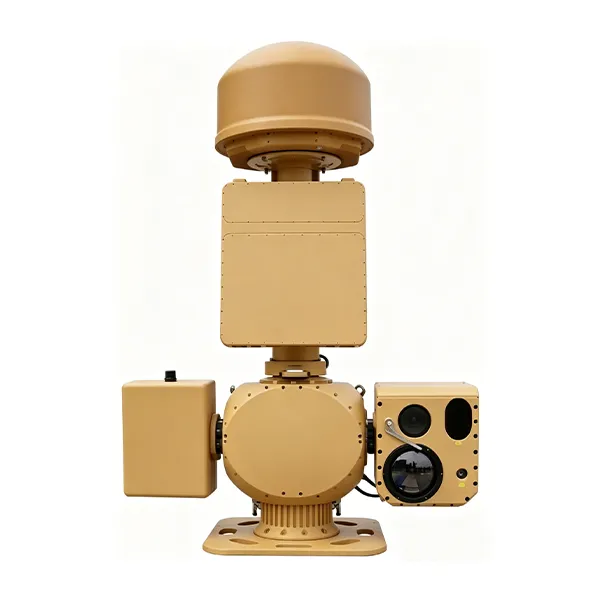
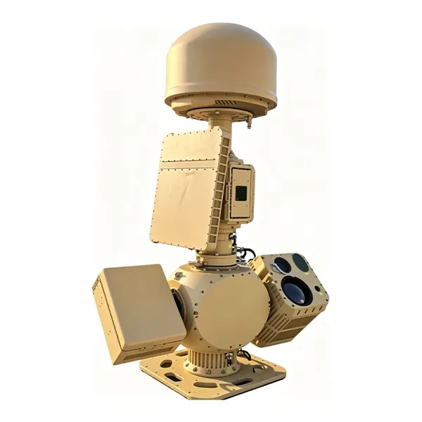
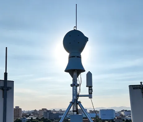
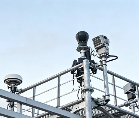
The MR-AUS70-RD05-RF05 Counter-UAV System integrates spectrum detection, radar detection, electro-optical tracking, interference response, navigation signal control, and a low-altitude target prevention, control and identification platform. The system uses spectrum detection and radar detection for target verification, then guides the electro-optical system for detection, tracking and identification. After the target type is confirmed, the system can link the radio interference response subsystem to interrupt UAV remote-control signals and apply navigation signal control, helping authorized operators manage low-altitude UAV activities within protected areas.
Preventivo gratuitoThe MR-AUS70-RD05-RF05 is a medium side-mounted integrated Counter-UAV system designed for low-altitude security protection.
It combines spectrum detection, radar detection, electro-optical tracking, AI target recognition, radio-link interference response, navigation signal control, and centralized platform management.
The system supports UAV signal detection and analysis, radar target detection, visible-light and thermal imaging tracking, target classification, coordinated system linkage, electronic map display, track recording, video playback, multi-screen display, and unattended operation.
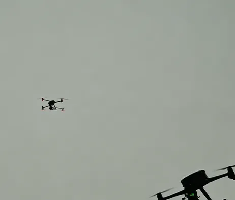
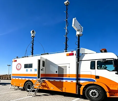
Highly Integrated System Architecture
Integrates spectrum detection, radar detection, electro-optical tracking, interference response, navigation signal control, and platform management into one coordinated system.
Multi-Function Spectrum Detection
Supports UAV signal detection, spectrum analysis, direction finding, and multi-target detection.
Radar Detection Capability
The radar subsystem adopts digital beam forming technology and supports target detection, tracking, and track output.
Electro-Optical Tracking
The electro-optical subsystem combines visible-light imaging, infrared thermal imaging, AI recognition, and servo pan-tilt tracking.
Coordinated Response Mechanism
After target verification, the system can link detection, tracking and response modules for coordinated low-altitude UAV management.
Modular Structure
Detection modules, response modules, and optical configurations can be flexibly configured according to project requirements.
Platform-Based Management
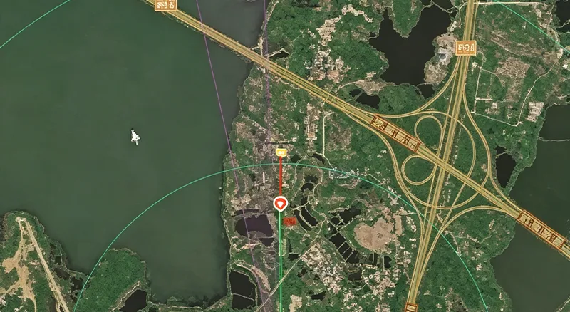
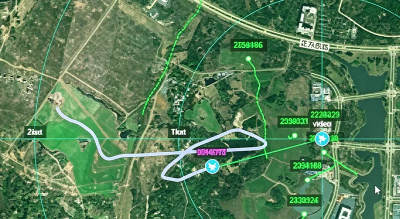
The RGS2000 platform supports centralized control, radar-electro-optical linkage, data fusion display, recording and playback, electronic map display, and unattended operation.
| Parametro | Specifiche | Parametro | Specifiche |
| Model & Working Range | |||
| Nome del Modello | MR-AUS70-RD05-RF05 Counter-UAV System | Typical Target | DJI Phantom 4, DJI Mavic 3 under good weather and electromagnetic conditions |
| Spectrum Direction Finding Range | ≥5 km | Radar Detection Range | ≥5 km |
| Visible-Light Tracking Range | ≥4 km | Thermal Imaging Tracking Range | ≥2 km |
| Interference Range | ≥5 km | Spoofing Range | ≥5 km |
| Spectrum Detection | |||
| Frequency Range | 300 MHz ~ 6000 MHz | Direction Finding Bands | 845 MHz, 915 MHz, 1.4 GHz, 2.4 GHz, 5.2 GHz, 5.8 GHz |
| Technical System | Spectrum features, positioning analysis | Direction Finding Accuracy | ≤5° RMS under standard site conditions |
| Simultaneous Detection Capacity | ≥30 UAVs | ||
| Radar Detection | |||
| Banda Radar | Banda X | Frequenza di aggiornamento | 2 s |
| Target Capacity | ≥200 tracks | Close-Range Blind Zone | ≤100 m |
| Copertura azimutale | 0° ~ 360° | Copertura dell'elevazione | 0° ~ 40° |
| Detection Altitude | ≥800 m | Accuracy RMS | Azimuth ≤0.4°, Elevation ≤0.4°, Range ≤10 m |
| Infrared Thermal Imaging | |||
| Rivelatore | Uncooled VOx infrared focal plane array | Risoluzione | 640 × 512 |
| Obiettivo | 23 ~ 230 mm, 10× continuous optical zoom | Controllo dell'Obiettivo | Motorized zoom, manual / automatic focus |
| Miglioramento dell'immagine | SDE digital image detail enhancement technology | ||
| Fotocamera a Luce Visibile HD | |||
| Sensore | 1/1.8″ starlight CMOS, ICR day/night switching | Risoluzione | 2688 × 1520 |
| Lunghezza focale | 12.5 ~ 775 mm HD motorized zoom lens | Anti-foschia | Supports optical / electronic dual defog |
| AI Tracking | |||
| Implementation | Front-end embedded hardware recognition and tracking | Tracking Mode | Manual tracking, automatic tracking, radar linkage supported |
| Riconoscimento | Supports classification of people, vehicles, vessels, UAVs and birds | Dataset Requirement | Customer assistance required for dataset provision |
| Servo Pan-Tilt | |||
| Struttura | Side-mounted, coaxial | Horizontal Range | N × 360° continuous rotation, mechanical lock after power-off |
| Pitch Range | -10° ~ +60°, with software limit, programmable | Velocità di rotazione | Horizontal 0.01° ~ 100°/s, Pitch 0.01° ~ 70°/s |
| Positioning Speed | Horizontal ≥120°/s, Pitch ≥100°/s | Acceleration | Horizontal 100°/s², Pitch 100°/s² |
| Interference & Spoofing | |||
| Interference Countermeasure Bands | 915 MHz / 1.4 GHz / 2.4 GHz / 5.2 GHz / 5.8 GHz | Single-Channel Power Amplifier | ≥50 W |
| Interference Power | Adjustable | Navigation Interference Bands | Adaptable to GPS, BD, GLONASS, GALILEO |
| Navigation Spoofing Bands | GPS-L1, GLONASS-R1, BD-B1, GALILEO-E1 | Supported Functions | Directional driving-away, navigation interference, regional no-fly control |
| Copertura azimutale | 0° ~ 360° | Interference Mode | Directional interference, spoofing |
| Other Function | Supports simultaneous link interference and navigation interference | Alimentazione | ≤1200 W |
| Overall System | |||
| Interfaccia di rete | 1 × 100M / 1000M adaptive Ethernet port | Alimentatore | AC220V ±20%, 50Hz |
| System Power Consumption | ≤2000 W | Dimensioni | L1300 mm × W600 mm × H2000 mm, reference |
| Peso Totale | ≤240 kg | Valutazione di protezione | IP66 |
| Temperatura di esercizio | -40℃ ~ +60℃ | ||
| RGS2000 Low-Altitude Target Prevention, Control and Identification System | |||
| Integrated Control & Display | Centralized control and display of radar, electro-optical, detection and interference systems | Situation Display | Dynamic display of UAV target points, spectrum direction finding and track information; spectrum-radar data fusion display |
| Information Recording | Supports radar, spectrum target tracks and video recording and playback | Auxiliary Tools | Supports distance, area and angle measurement; static calibration azimuth calculation; radar-EO assisted calibration |
| Electronic Map | Supports electronic maps and device coordinate locations; online and offline 2D maps | Multi-Screen Display | Supports split-screen display of video preview, electronic map, video monitoring, video playback and information management |
| Unattended Operation | Supports track data fusion, automatic radar-EO linkage and unattended system operation | ||
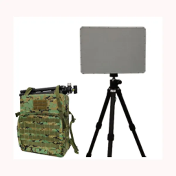
Radar a matrice phased array AESA in banda X progettato per il rilevamento continuo di bersagli in movimento su terra e acqua con alta sensibilità, basso tasso di falsi allarmi e tracciamento accurato.
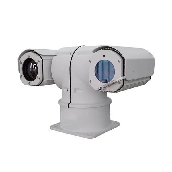
Realizzata per la sorveglianza mobile a lungo raggio, questa termocamera montata su veicolo combina l'osservazione termica, l'acquisizione di immagini in luce visibile, gli allarmi intelligenti e il controllo dell'inclinazione ad alta velocità per le applicazioni di sicurezza all'aperto più esigenti.
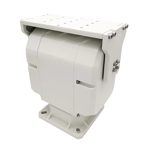
Pan-tilt a doppio asse per impieghi gravosi, progettato per un controllo intelligente, prestazioni di movimento stabili e supporto affidabile per sistemi integrati di sorveglianza e tracciamento all'aperto.
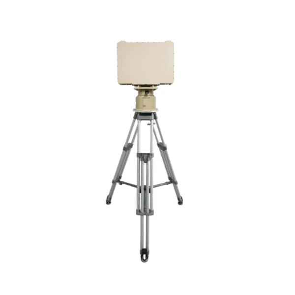
Banco economico e facile da usare, con manometri e controllo manuale.

Contattateci e vi risponderemo al più presto.
Vi risponderemo entro 24 ore. Se per il caso urgente, si prega di aggiungere WhatsApp/WeChat: +86 15954290051,. Oppure chiamare direttamente il numero +86 15964215221.
*Rispettiamo la vostra riservatezza e tutte le informazioni sono protette.
Utilizzeremo le vostre informazioni solo per rispondere alle vostre richieste e non invieremo mai e-mail non richieste o messaggi promozionali.