

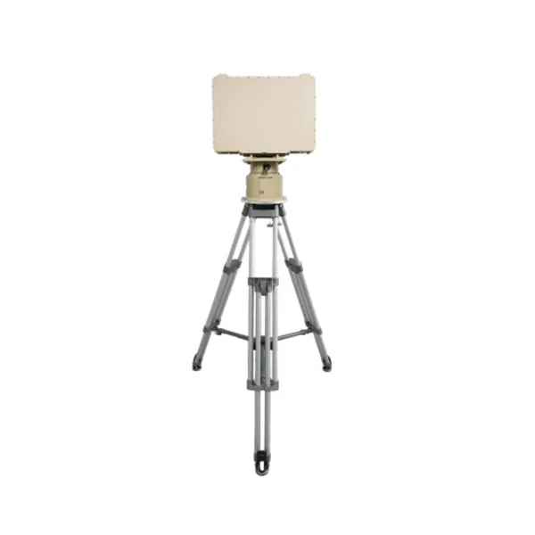
Radar de Matriz en Fase MR-RDG07K
Radar de matriz en fase AESA de banda X diseñado para la detección continua de objetivos en movimiento en tierra y agua con alta sensibilidad, baja tasa de falsas alarmas y seguimiento preciso.
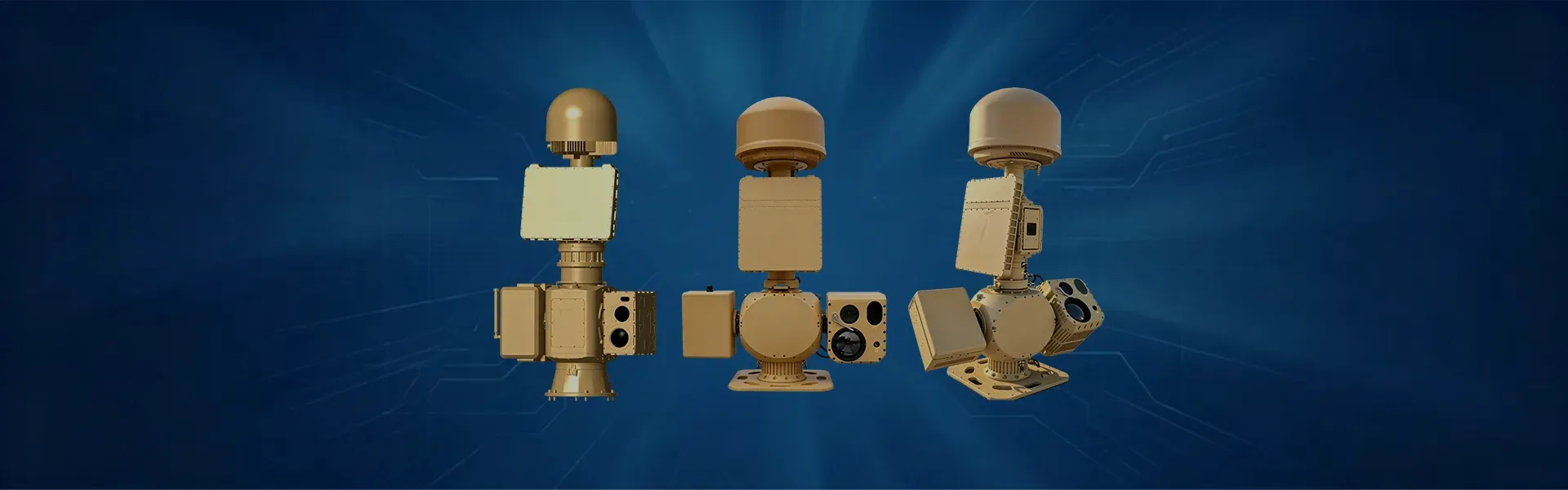
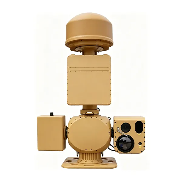
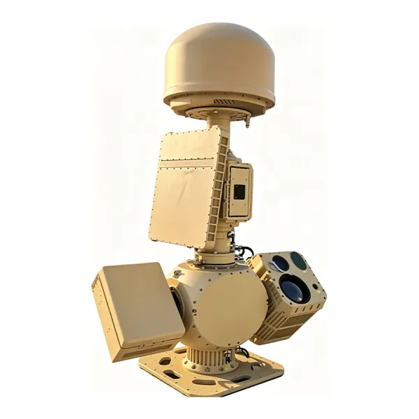
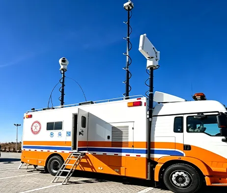
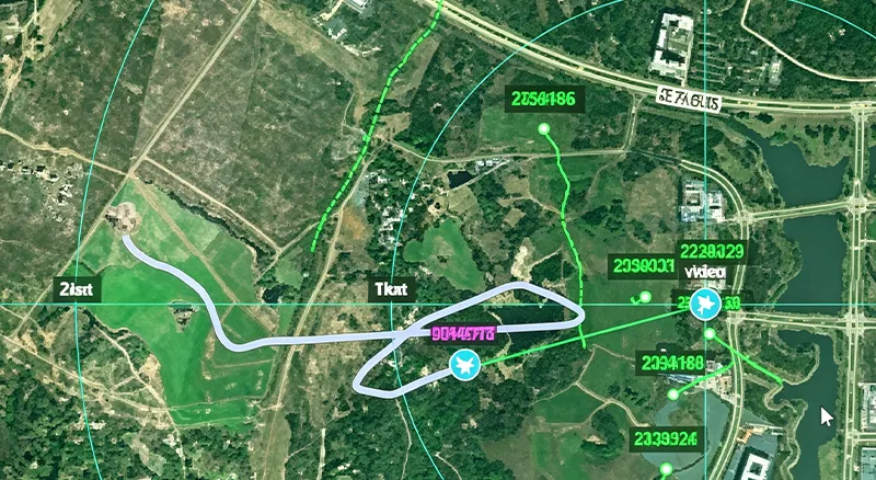
The MR-AUS70-RD05-RF10 Counter-UAV System integrates spectrum detection, radar detection, electro-optical tracking, interference response, navigation signal control, and a low-altitude target prevention, control and identification platform. The system uses spectrum detection and radar detection for target verification, then guides the electro-optical system for detection, tracking and identification. After the target type is confirmed, the system can link the radio interference response subsystem to interrupt UAV remote-control signals and apply navigation signal control, supporting authorized operators in managing low-altitude UAV activities within protected areas.
Obtener presupuesto gratuitoThe MR-AUS70-RD05-RF10 is a medium side-mounted integrated Counter-UAV system designed for low-altitude security protection.
It combines spectrum detection, radar detection, electro-optical tracking, AI target recognition, radio-link interference response, navigation signal control, and centralized platform management.
Compared with the RF05 version, this configuration uses a cooled MCT infrared focal plane array and supports longer spectrum direction-finding range, longer thermal imaging tracking range, and longer navigation spoofing range according to the original specification.
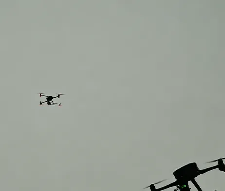
Highly Integrated System Architecture
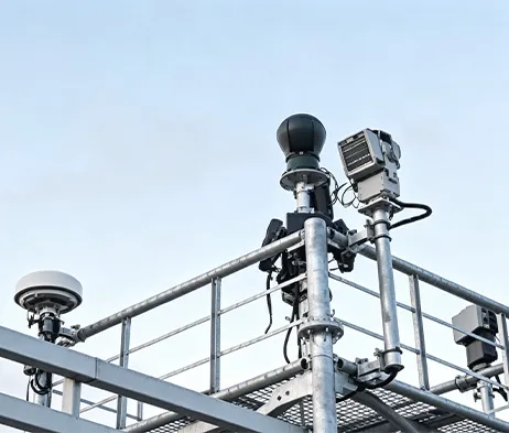
Integrates spectrum detection, radar detection, electro-optical tracking, interference response, navigation signal control, and platform management into one coordinated system.
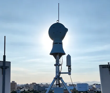
Multi-Function Spectrum Detection
Supports UAV signal detection, spectrum feature analysis, positioning analysis, direction finding, and multi-target detection.
Radar Detection Capability
The radar subsystem adopts digital beam forming technology and supports target detection, tracking, and track output.
Cooled Thermal Imaging Configuration
Uses a cooled MCT infrared focal plane array with 640 × 512 resolution and 40–800mm continuous optical zoom lens.
Electro-Optical Tracking
Combines visible-light imaging, infrared thermal imaging, AI recognition, and servo pan-tilt tracking.
Coordinated Response Mechanism
Supports coordinated linkage between detection, tracking, identification, interference response, and navigation signal control modules.
Platform-Based Management
The RGS2000 platform supports centralized control, data fusion display, recording and playback, electronic map display, multi-screen display, and unattended operation.
| Parámetro | Especificación | Parámetro | Especificación |
| Model & Working Range | |||
| Nombre del Modelo | MR-AUS70-RD05-RF10 Counter-UAV System | Typical Target | DJI Phantom 4, DJI Mavic 3 under good weather and electromagnetic conditions |
| Spectrum Direction Finding Range | ≥10 km | Radar Detection Range | ≥5 km |
| Visible-Light Tracking Range | ≥4 km | Thermal Imaging Tracking Range | ≥4 km |
| Interference Range | ≥5 km | Spoofing Range | ≥10 km |
| Spectrum Detection | |||
| Frequency Range | 300 MHz ~ 6000 MHz | Direction Finding Bands | 300 MHz ~ 6000 MHz |
| Technical System | Spectrum features, positioning analysis | Direction Finding Accuracy | ≤5° RMS under standard site conditions |
| Simultaneous Detection Capacity | ≥30 UAVs | ||
| Radar Detection | |||
| Banda de radar | Banda X | Frecuencia de actualización | 2 s |
| Target Capacity | ≥200 tracks | Close-Range Blind Zone | ≤100 m |
| Cobertura acimutal | 0° ~ 360° | Cobertura de elevación | 0° ~ 40° |
| Detection Altitude | ≥800 m | Accuracy RMS | Azimuth ≤0.4°, Elevation ≤0.4°, Range ≤10 m |
| Infrared Thermal Imaging | |||
| Detector | Cooled MCT infrared focal plane array | Resolución | 640 × 512 |
| Lente | 40 ~ 800 mm, 20× continuous optical zoom | Control de lente | Motorized zoom, manual / automatic focus |
| Mejora de la imagen | SDE digital image detail enhancement technology | ||
| Cámara de Luz Visible HD | |||
| Sensor | 1/1.8″ starlight CMOS, ICR day/night switching | Resolución | 2688 × 1520 |
| Distancia focal | 12.5 ~ 775 mm HD motorized zoom lens | Desempañar | Supports optical / electronic dual defog |
| AI Tracking | |||
| Implementation | Front-end embedded hardware recognition and tracking | Tracking Mode | Manual tracking, automatic tracking, radar linkage supported |
| Reconocimiento | Supports classification of people, vehicles, vessels, UAVs and birds | Dataset Requirement | Customer assistance required for dataset provision |
| Servo Pan-Tilt | |||
| Estructura | Side-mounted, coaxial | Horizontal Range | N × 360° continuous rotation, mechanical lock after power-off |
| Pitch Range | -10° ~ +60°, with software limit, programmable | Velocidad de Rotación | Horizontal 0.01° ~ 100°/s, Pitch 0.01° ~ 70°/s |
| Positioning Speed | Horizontal ≥120°/s, Pitch ≥100°/s | Acceleration | Horizontal 100°/s², Pitch 100°/s² |
| Interference & Spoofing | |||
| Interference Coverage Bands | 300 MHz ~ 6 GHz | Typical Response Bands | 915 MHz / 1.4 GHz / 2.4 GHz / 5.2 GHz / 5.8 GHz |
| Single-Channel Power Amplifier | ≥50 W | Interference Power | Adjustable |
| Navigation Interference Bands | Adaptable to GPS, BD, GLONASS, GALILEO | Navigation Spoofing Bands | GPS-L1, GLONASS-R1, BD-B1, GALILEO-E1 |
| Supported Functions | Directional driving-away, navigation interference, regional no-fly control | Cobertura acimutal | 0° ~ 360° |
| Interference Mode | Directional interference, spoofing | Other Function | Supports simultaneous link interference and navigation interference |
| Alimentación | ≤1200 W | ||
| Overall System | |||
| Interfaz de red | 1 × 100M / 1000M adaptive Ethernet port | Fuente de alimentación | AC220V ±20%, 50Hz |
| System Power Consumption | ≤2000 W | Dimensiones | L1300 mm × W600 mm × H2000 mm, reference |
| Peso total | ≤260 kg | Clasificación de Protección | IP66 |
| Temperatura de funcionamiento | -40℃ ~ +60℃ | ||
| RGS2000 Platform | |||
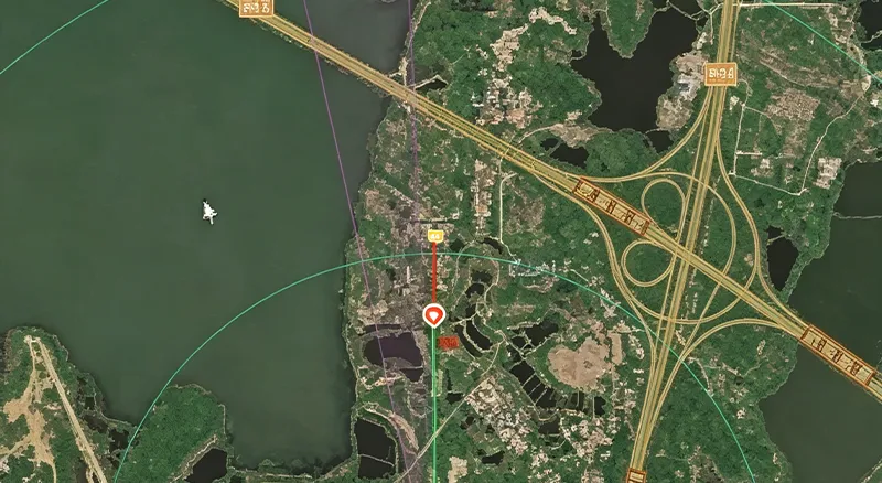
| Integrated Control & Display | Centralized control and display of radar, electro-optical, detection and interference systems | Situation Display | Dynamic display of UAV target points, spectrum direction finding and track information; spectrum-radar data fusion display |
| Information Recording | Supports radar, spectrum target tracks and video recording and playback | Auxiliary Tools | Supports distance, area and angle measurement; static calibration azimuth calculation; radar-EO assisted calibration |
| Electronic Map | Supports electronic maps and device coordinate locations; online and offline 2D maps | Multi-Screen Display | Supports split-screen display of video preview, electronic map, video monitoring, video playback and information management |
| Unattended Operation | Supports track data fusion, automatic radar-EO linkage and unattended system operation | ||
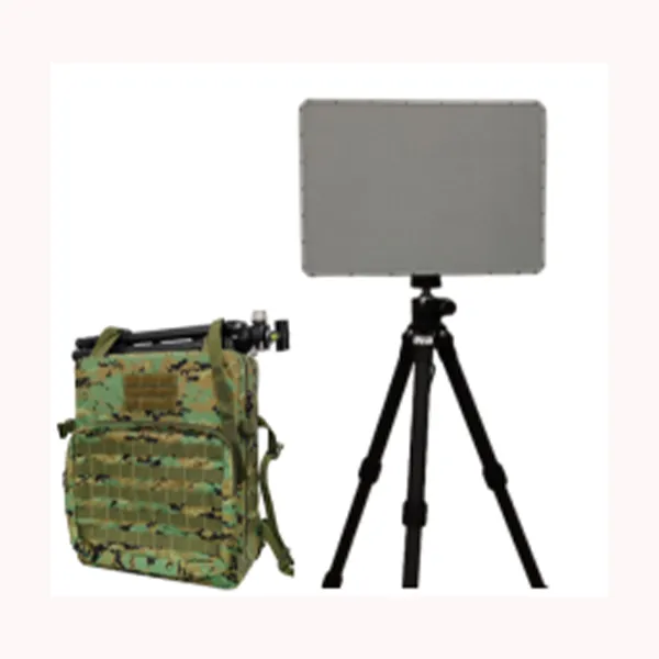
Radar de matriz en fase AESA de banda X diseñado para la detección continua de objetivos en movimiento en tierra y agua con alta sensibilidad, baja tasa de falsas alarmas y seguimiento preciso.
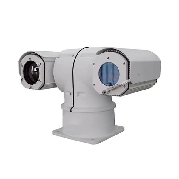
Diseñada para la vigilancia móvil de largo alcance, esta cámara termográfica montada en vehículo combina observación térmica, imágenes de luz visible, alarmas inteligentes y control de movimiento horizontal y vertical de alta velocidad para las exigentes aplicaciones de seguridad en exteriores.
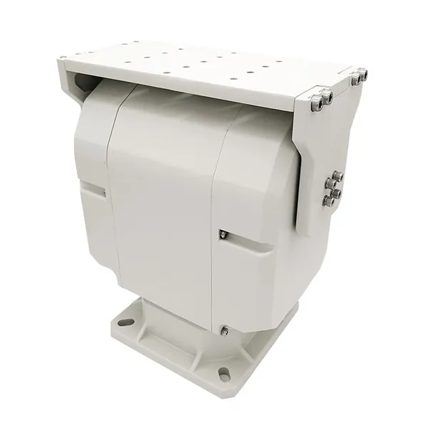
Inclinación panorámica de doble eje de alta resistencia diseñada para un control inteligente, un rendimiento de movimiento estable y un soporte fiable para sistemas integrados de vigilancia y seguimiento en exteriores.
Banco económico y fácil de manejar con manómetros y control manual.

Póngase en contacto con nosotros y le responderemos lo antes posible.
Le responderemos en un plazo de 24 horas. Si para el caso urgente, por favor agregue WhatsApp/WeChat: +86 15954290051,. O llame directamente al +86 15964215221.
*Respetamos su confidencialidad y toda la información está protegida.
Sólo utilizaremos sus datos para responder a su consulta y nunca le enviaremos correos electrónicos o mensajes promocionales no solicitados.