

Radar mảng pha MR-RDG07K
Radar mảng pha AESA băng tần X được thiết kế để phát hiện mục tiêu di chuyển trên đất liền và mặt nước liên tục với độ nhạy cao, tỷ lệ báo động giả thấp và khả năng theo dõi chính xác.

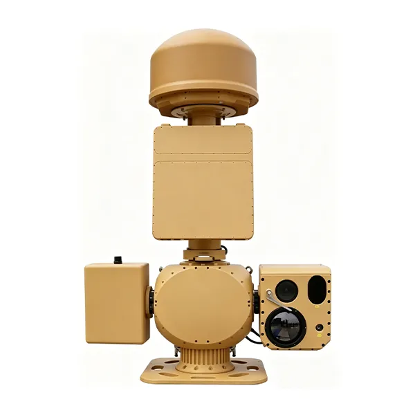
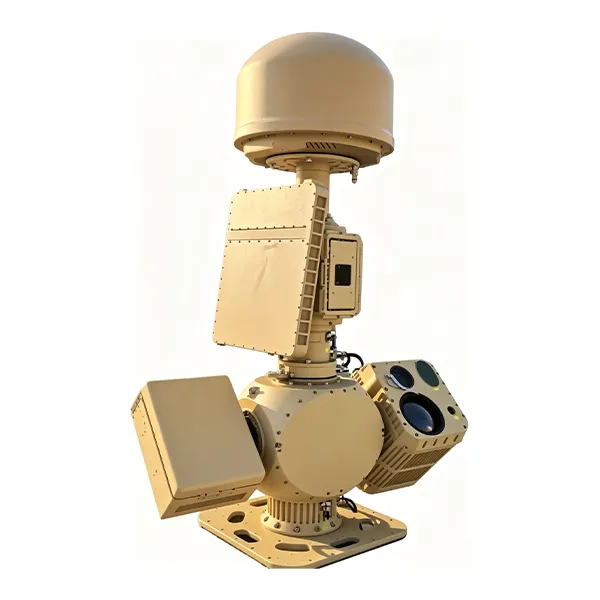
The MR-AUS70-RD05-RF10 Counter-UAV System integrates spectrum detection, radar detection, electro-optical tracking, interference response, navigation signal control, and a low-altitude target prevention, control and identification platform. The system uses spectrum detection and radar detection for target verification, then guides the electro-optical system for detection, tracking and identification. After the target type is confirmed, the system can link the radio interference response subsystem to interrupt UAV remote-control signals and apply navigation signal control, supporting authorized operators in managing low-altitude UAV activities within protected areas.
Nhận báo giá miễn phíThe MR-AUS70-RD05-RF10 is a medium side-mounted integrated Counter-UAV system designed for low-altitude security protection.
It combines spectrum detection, radar detection, electro-optical tracking, AI target recognition, radio-link interference response, navigation signal control, and centralized platform management.
Compared with the RF05 version, this configuration uses a cooled MCT infrared focal plane array and supports longer spectrum direction-finding range, longer thermal imaging tracking range, and longer navigation spoofing range according to the original specification.
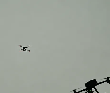
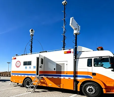
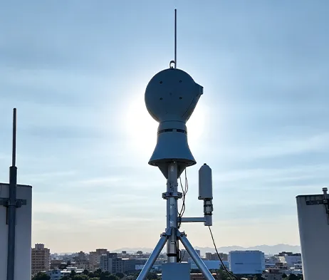
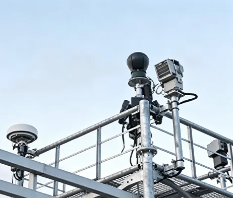
Highly Integrated System Architecture
Integrates spectrum detection, radar detection, electro-optical tracking, interference response, navigation signal control, and platform management into one coordinated system.
Multi-Function Spectrum Detection
Supports UAV signal detection, spectrum feature analysis, positioning analysis, direction finding, and multi-target detection.
Radar Detection Capability
The radar subsystem adopts digital beam forming technology and supports target detection, tracking, and track output.
Cooled Thermal Imaging Configuration
Uses a cooled MCT infrared focal plane array with 640 × 512 resolution and 40–800mm continuous optical zoom lens.
Electro-Optical Tracking
Combines visible-light imaging, infrared thermal imaging, AI recognition, and servo pan-tilt tracking.
Coordinated Response Mechanism
Supports coordinated linkage between detection, tracking, identification, interference response, and navigation signal control modules.
Platform-Based Management
The RGS2000 platform supports centralized control, data fusion display, recording and playback, electronic map display, multi-screen display, and unattended operation.
| Tham số | Thông số | Tham số | Thông số |
| Model & Working Range | |||
| Tên Mẫu | MR-AUS70-RD05-RF10 Counter-UAV System | Typical Target | DJI Phantom 4, DJI Mavic 3 under good weather and electromagnetic conditions |
| Spectrum Direction Finding Range | ≥10 km | Radar Detection Range | ≥5 km |
| Visible-Light Tracking Range | ≥4 km | Thermal Imaging Tracking Range | ≥4 km |
| Interference Range | ≥5 km | Spoofing Range | ≥10 km |
| Spectrum Detection | |||
| Frequency Range | 300 MHz ~ 6000 MHz | Direction Finding Bands | 300 MHz ~ 6000 MHz |
| Technical System | Spectrum features, positioning analysis | Direction Finding Accuracy | ≤5° RMS under standard site conditions |
| Simultaneous Detection Capacity | ≥30 UAVs | ||
| Radar Detection | |||
| Băng tần Radar | Băng X | Tần số làm mới | 2 s |
| Target Capacity | ≥200 tracks | Close-Range Blind Zone | ≤100 m |
| Phạm vi góc phương vị | 0° ~ 360° | Phạm vi độ cao | 0° ~ 40° |
| Detection Altitude | ≥800 m | Accuracy RMS | Azimuth ≤0.4°, Elevation ≤0.4°, Range ≤10 m |
| Infrared Thermal Imaging | |||
| Bộ phát hiện | Cooled MCT infrared focal plane array | Độ phân giải | 640 × 512 |
| Ống kính | 40 ~ 800 mm, 20× continuous optical zoom | Kiểm soát ống kính | Motorized zoom, manual / automatic focus |
| Cải thiện chất lượng hình ảnh | SDE digital image detail enhancement technology | ||
| Camera ánh sáng nhìn thấy HD | |||
| Cảm biến | 1/1.8″ starlight CMOS, ICR day/night switching | Độ phân giải | 2688 × 1520 |
| Tiêu cự | 12.5 ~ 775 mm HD motorized zoom lens | Xóa sương mù | Supports optical / electronic dual defog |
| AI Tracking | |||
| Implementation | Front-end embedded hardware recognition and tracking | Tracking Mode | Manual tracking, automatic tracking, radar linkage supported |
| Sự công nhận | Supports classification of people, vehicles, vessels, UAVs and birds | Dataset Requirement | Customer assistance required for dataset provision |
| Servo Pan-Tilt | |||
| Cấu trúc | Side-mounted, coaxial | Horizontal Range | N × 360° continuous rotation, mechanical lock after power-off |
| Pitch Range | -10° ~ +60°, with software limit, programmable | Tốc độ quay | Horizontal 0.01° ~ 100°/s, Pitch 0.01° ~ 70°/s |
| Positioning Speed | Horizontal ≥120°/s, Pitch ≥100°/s | Acceleration | Horizontal 100°/s², Pitch 100°/s² |
| Interference & Spoofing | |||
| Interference Coverage Bands | 300 MHz ~ 6 GHz | Typical Response Bands | 915 MHz / 1.4 GHz / 2.4 GHz / 5.2 GHz / 5.8 GHz |
| Single-Channel Power Amplifier | ≥50 W | Interference Power | Adjustable |
| Navigation Interference Bands | Adaptable to GPS, BD, GLONASS, GALILEO | Navigation Spoofing Bands | GPS-L1, GLONASS-R1, BD-B1, GALILEO-E1 |
| Supported Functions | Directional driving-away, navigation interference, regional no-fly control | Phạm vi góc phương vị | 0° ~ 360° |
| Interference Mode | Directional interference, spoofing | Other Function | Supports simultaneous link interference and navigation interference |
| Nguồn điện | ≤1200 W | ||
| Overall System | |||
| Giao diện mạng | 1 × 100M / 1000M adaptive Ethernet port | Nguồn cung cấp | AC220V ±20%, 50Hz |
| System Power Consumption | ≤2000 W | Kích thước | L1300 mm × W600 mm × H2000 mm, reference |
| Tổng trọng lượng | ≤260 kg | Đánh giá bảo vệ | IP66 |
| Nhiệt độ hoạt động | -40°C ~ +60°C | ||
| RGS2000 Platform | |||
| Integrated Control & Display | Centralized control and display of radar, electro-optical, detection and interference systems | Situation Display | Dynamic display of UAV target points, spectrum direction finding and track information; spectrum-radar data fusion display |
| Information Recording | Supports radar, spectrum target tracks and video recording and playback | Auxiliary Tools | Supports distance, area and angle measurement; static calibration azimuth calculation; radar-EO assisted calibration |
| Electronic Map | Supports electronic maps and device coordinate locations; online and offline 2D maps | Multi-Screen Display | Supports split-screen display of video preview, electronic map, video monitoring, video playback and information management |
| Unattended Operation | Supports track data fusion, automatic radar-EO linkage and unattended system operation | ||
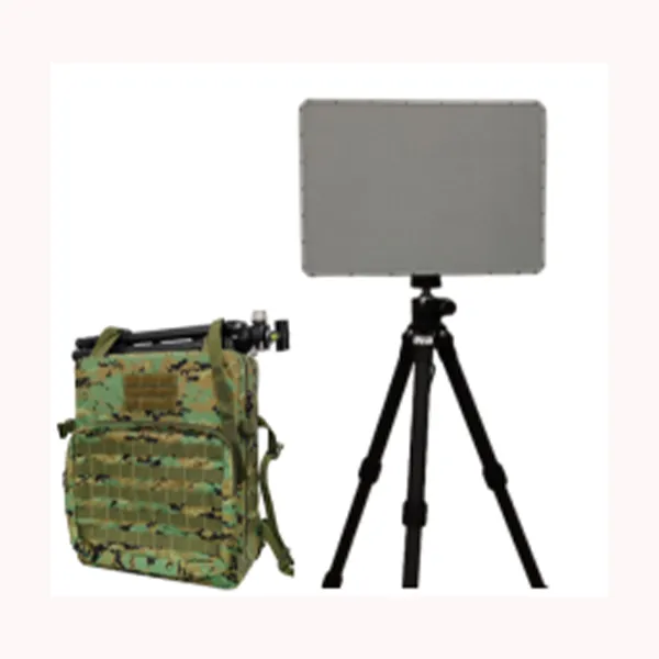
Radar mảng pha AESA băng tần X được thiết kế để phát hiện mục tiêu di chuyển trên đất liền và mặt nước liên tục với độ nhạy cao, tỷ lệ báo động giả thấp và khả năng theo dõi chính xác.
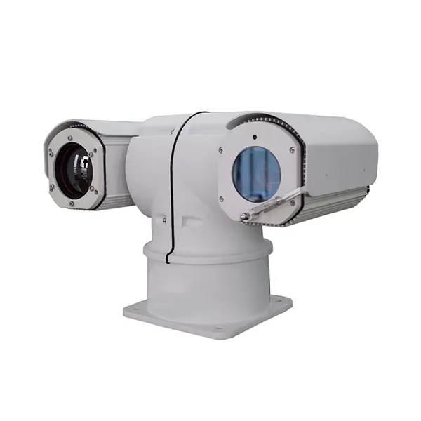
Được thiết kế dành cho nhiệm vụ giám sát di động tầm xa, camera hồng ngoại gắn trên xe này tích hợp các tính năng quan sát hồng ngoại, chụp ảnh ánh sáng khả kiến, cảnh báo thông minh và điều khiển xoay nghiêng tốc độ cao, đáp ứng các yêu cầu khắt khe của các ứng dụng an ninh ngoài trời.
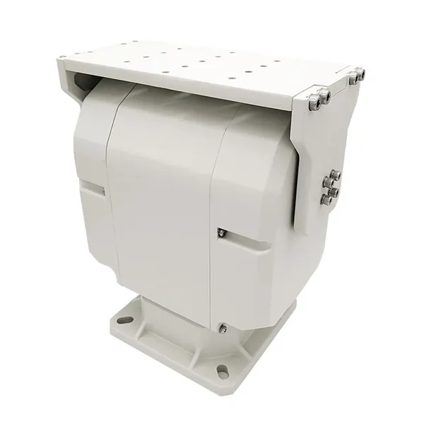
Bộ xoay nghiêng hai trục chịu tải nặng được thiết kế để điều khiển thông minh, mang lại hiệu suất chuyển động ổn định và hỗ trợ đáng tin cậy cho các hệ thống giám sát và theo dõi ngoài trời tích hợp.
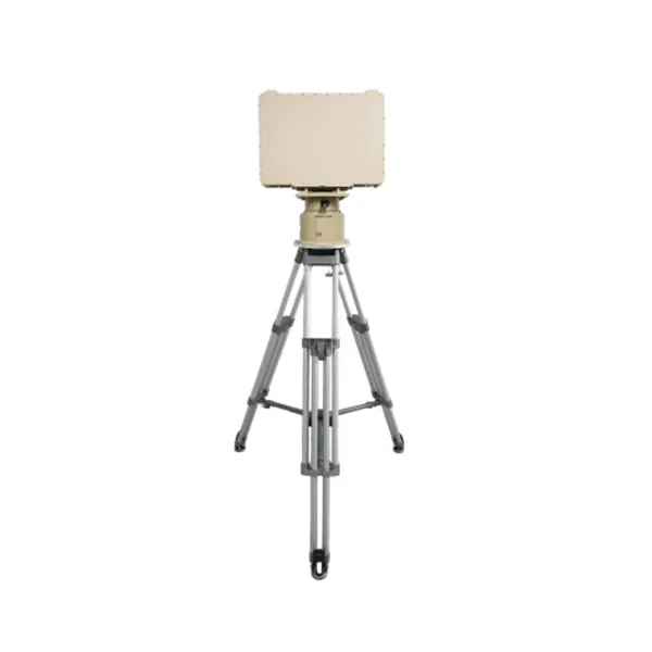
Bàn thí nghiệm tiết kiệm chi phí, dễ vận hành, được trang bị đồng hồ đo áp suất và hệ thống điều khiển bằng tay.

Vui lòng liên hệ với chúng tôi và chúng tôi sẽ phản hồi lại quý khách sớm nhất có thể.
Chúng tôi sẽ trả lời quý khách trong vòng 24 giờ. Nếu trường hợp khẩn cấp, vui lòng thêm số WhatsApp/WeChat: +86 15954290051. Hoặc gọi trực tiếp đến số +86 15964215221.
*Chúng tôi tôn trọng quyền riêng tư của quý khách và tất cả thông tin đều được bảo mật.
Chúng tôi chỉ sử dụng thông tin của bạn để trả lời câu hỏi của bạn và sẽ không bao giờ gửi email hoặc tin nhắn quảng cáo không được yêu cầu.