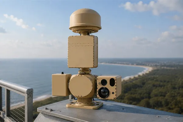
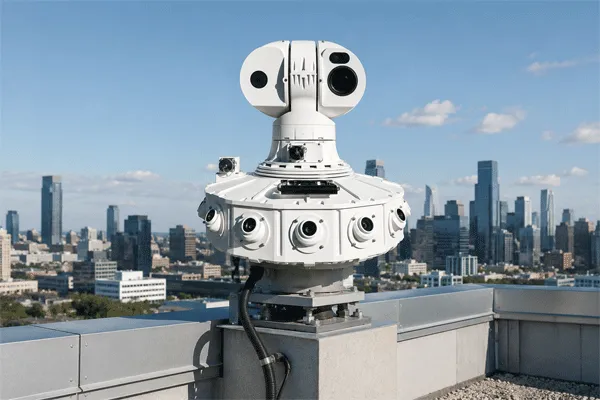
Buying a drone detection or low-altitude surveillance radar system is a capability-acquisition project, not a catalogue-selection exercise. The buyer must translate a threat, a site and a response workflow into measurable detection, tracking, verification, integration and acceptance requirements.
The same brochure terms—“360-degree drone detection,” “AI classification” and “radar-camera linkage”—can describe materially different project boundaries. A defensible procurement document therefore states the required capability, evidence, interfaces and delivery outputs instead of relying on headline specifications.
Start with the required operating outcome, not a preferred radar model or supplier score. Define the CONOPS, assign each sensor a role, freeze data and interface requirements, design coverage, establish evidence submissions, plan field trials and agree acceptance criteria before issuing the controlled RFI or RFP. Commercial comparison belongs to the separate quotation-comparison stage after compliant responses are received.
Still defining the coverage class? First use Midradar’s low-altitude surveillance radar selection guide to separate local, facility-wide and long-range coverage needs; then return to this guide to write the technical, interface, test and acceptance requirements.
This guide focuses on detection, tracking, identification support and system integration. Laws governing radio monitoring, communications interception, jamming, spoofing, takeover or physical mitigation vary by jurisdiction. Detection authority and mitigation authority are not the same. Buyers should obtain local legal, aviation, spectrum and security approval before acquiring or activating any response function.
FAA guidance on UAS detection, mitigation and response at airports illustrates why technical deployment must be coordinated with aviation, electromagnetic-interference and legal requirements. The same principle applies globally: local approvals belong in the procurement plan, not as an afterthought.
Drone Detection & Low-Altitude Surveillance Radar Procurement Guide (2026)
1. Define the Procurement Boundary Before Writing Specifications
The first procurement question is not “Which radar should we buy?” It is “What capability are we acquiring?” The answer should state where the system begins and ends.
| Acquisition Boundary |
Typical Scope |
What the Buyer Must Still Provide |
| Detection sensor |
Radar or RF sensor, local software and track output |
Coverage design, verification sensor, C2 workflow, integration, response procedure |
| Detection and tracking system |
One or more sensors, track management, alerts and event display |
Visual confirmation, external platform integration, response authority and SOPs |
| DTI system |
Detection, tracking and identification-support workflow using radar, RF and/or EO/IR |
Threat assessment, operator decision, evidence policy and authorized response |
| Integrated C-UAS solution |
Sensors, fusion, C2, response interfaces, logging and support |
Legal authorization, rules of engagement, governance and independent acceptance |
The buyer should also separate three different outputs:
- Detection: evidence that an object or signal is present in the monitored area.
- Tracking: a time-correlated estimate of position, velocity, direction and track history.
- Identification support: information that helps an operator assess the object, such as EO/IR imagery, RF attributes, Remote ID data or classification confidence.
A sensor alert does not establish hostile intent. The system can support situational awareness and decision-making, but the organization must define who reviews the evidence, who assigns the threat level and who is authorized to respond.
2. Build the Threat Model and Operational Concept
A threat model defines what must be observed. An operational concept, or CONOPS, defines how the organization will use the information. Both are required before performance specifications can be meaningful.
| Requirement Element |
Buyer Definition |
Why It Changes the Design |
| Protected asset |
Runway, terminal, power substation, tank farm, port, prison, border sector or public venue |
Determines coverage boundaries, consequence of missed detection and response priorities |
| Target set |
Multirotor, fixed-wing UAV, FPV platform, bird, helicopter, vehicle or person |
Changes radar cross-section, speed, altitude, maneuver and classification requirements |
| Target behavior |
Hovering, slow approach, terrain-following, high-speed transit, swarm or RF-silent route |
Changes low-velocity filters, update rate, track capacity and sensor mix |
| Operating environment |
Urban, industrial, desert, coastal, mountainous, forested or airport environment |
Changes clutter, multipath, line of sight, weather exposure and spectrum constraints |
| Required warning time |
Time needed for verification, escalation and response |
Converts operational response time into a practical detection-distance requirement |
| Response workflow |
Observe, verify, notify, dispatch, record or activate an authorized countermeasure |
Determines C2 functions, latency, evidence, permissions and audit requirements |
| Availability target |
Operating hours, permitted downtime and maintenance windows |
Determines redundancy, spares, support and lifecycle cost |
The buyer should define targets by a testable description rather than a generic label. “Small drone” is not enough. A useful requirement identifies the representative target, payload or configuration, flight profile, speed range, altitude range, approach direction and test method. When an RCS value is used, the supplier should explain how it was obtained and whether it is a measured, modeled or assumed value.
Warning time should also be calculated backward from the response process. If operators need time to confirm an object, notify an authority and deploy a response team, the detection requirement must support that total timeline under the relevant approach speed. A nominal maximum range that does not provide usable track continuity or visual handoff is not an operational requirement.
3. Choose the Architecture by Sensor Role
No sensing technology observes every aspect of a low-altitude event. A strong architecture assigns a defined role to each input and explains how the data is correlated. Multi-sensor procurement should not produce several independent alarm screens.
| Sensor or Data Layer |
Primary Contribution |
Key Limitation to Test |
| Surveillance radar |
Detects physical objects and provides range, direction, velocity and track continuity independent of control-link emissions |
Clutter, line of sight, minimum velocity, small-target performance and classification confidence |
| RF detection |
Observes compatible control, telemetry or video-link emissions and may provide protocol or controller context |
Cannot be assumed to detect autonomous, unfamiliar, low-power or non-emitting targets |
| EO/IR camera |
Provides visual or thermal confirmation, imagery and evidential recording |
Requires line of sight; performance depends on optics, atmosphere, target contrast and cueing accuracy |
| Remote ID / airspace data |
Provides cooperative identification or authorization context where available |
Coverage, compliance and data availability vary; absence of data is not proof of hostility |
| Acoustic sensor |
Can provide local passive detection or directional cues in selected environments |
Range and reliability are sensitive to wind, machinery, traffic and background noise |
| Fusion and C2 platform |
Normalizes inputs, correlates tracks, prioritizes alerts, cues cameras and records events |
Poor time synchronization, coordinate conversion or interface discipline can undermine the entire system |
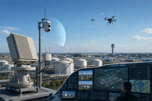
Radar is commonly selected as the wide-area physical-detection layer when the buyer must observe objects that may not transmit a recognizable RF signal. RF sensing can add signal context. EO/IR supports visual review and evidence. Cooperative airspace data can reduce ambiguity around authorized activity. The correct combination depends on the threat model and operating environment; it should not be fixed by a generic product bundle.
For a system-level view of how the layers can be organized, review Midradar’s integrated counter-UAV architecture. For projects focused on detection and visual verification without a mitigation layer, the radar-vision fusion portfolioprovides the more relevant reference path.
Open interfaces reduce dependence on a single supplier. The UK Ministry of Defence’s SAPIENT autonomous sensor architectureis one example of an openly described approach to connecting sensor, fusion and decision-making modules. A buyer does not need to mandate SAPIENT in every project, but should require documented message structures, testable interfaces and ownership of integration responsibilities.

Drone Detection & Low-Altitude Surveillance Radar Procurement Guide (2026)
4. Radar Requirements for Drone Detection: What to Specify
Radar procurement should distinguish product specifications from project guarantees. A datasheet describes a product under stated conditions. A project requirement defines the performance to be demonstrated for the buyer’s target, site and test method.
4.1 Target-Specific Detection and Stable Tracking
Require separate values for first detection, track initiation, confirmed track and stable tracking. A brief detection is not equivalent to an operational track. Camera cueing and alarm decisions normally depend on track continuity, coordinate quality and predictable updates.
Every quoted range should identify the representative target, altitude, speed, aspect, environmental condition, probability or confidence condition, and whether the value is modeled, laboratory-tested or field-demonstrated. Avoid imposing one universal RCS benchmark across all target classes; use a buyer-defined reference target and an agreed test profile.
4.2 Coverage Geometry and Blind Zones
Range alone does not describe coverage. The supplier should define azimuth coverage, elevation coverage, minimum range, maximum instrumented range, altitude coverage at relevant distances, terrain masking, structure masking, overlap between sensors and the number of units required. A site-specific coverage drawing should show assumptions and excluded zones.
4.3 Update Rate, Latency and Track Quality
The buyer should specify the track-output interval, end-to-end alert latency, time synchronization method and data age delivered to external systems. Update rate should be evaluated against target speed, maneuver and camera field of view. The requirement is not simply the fastest advertised scan; it is a usable track delivered with known latency and accuracy.
4.4 Clutter, False Alarms and Classification
False-alarm requirements must be tied to the site, operating mode and measurement period. A universal “alarms per hour” threshold is not credible without defining birds, vehicles, weather, rotating equipment, permitted zones and operator settings. Require the supplier to state how false alarms are counted, how classification confidence is represented and how performance changes when filters are tightened.
4.5 Capacity, Data and Health Monitoring
Specify the simultaneous track capacity under the proposed configuration, not the theoretical software maximum. Require unique track identifiers, quality or confidence fields, sensor status, fault alarms, time synchronization status, event logs and export functions. The C2 platform should show when confidence has degraded rather than presenting all tracks as equally reliable.
| Radar Requirement |
Minimum Supplier Response |
| Reference targets |
Target description, configuration, representative RCS basis if used, speed, altitude and approach geometry |
| Performance stages |
First detection, track initiation, confirmed track and stable-tracking range |
| Coverage |
Azimuth, elevation, minimum range, altitude coverage, blind zones and required sensor count |
| Track output |
Update interval, latency, coordinate system, accuracy, velocity, track confidence and timestamp |
| Clutter performance |
Site assumptions, suppression method, minimum detectable velocity and impact of filtering |
| Classification |
Supported classes, confidence output, unknown class handling and field-validation method |
| Capacity |
Sustained simultaneous tracks under the quoted scan mode and output rate |
| Environmental |
Operating temperature, ingress protection, wind, lightning, salt fog, dust and EMC evidence as applicable |
| Maintenance |
Calibration needs, preventive maintenance, consumables, spares and remote diagnostics |
Use Midradar’s low-altitude surveillance radar portfolio to identify candidate product classes. The product shortlist should follow the requirement and coverage study; it should not replace them. For a broader family comparison, use the current radar catalog.
5. Specify Integration Before Selecting Hardware
Integration failure is usually caused by undefined responsibilities rather than by a missing network port. “API available” does not confirm that the supplier will deliver the data, documentation, coordinate conversion, camera driver, cybersecurity controls and acceptance testing needed for an operational system.
| Integration Area |
Requirement to Freeze Before Award |
| Track interface |
Message format, field definitions, units, coordinate reference, timestamps, update frequency and quality indicators |
| Time synchronization |
NTP/PTP or other method, permitted drift, loss-of-sync alarm and behavior during degraded time service |
| EO/IR cueing |
Coordinate conversion, terrain model, camera driver, preset management, calibration, latency and target-in-frame acceptance |
| Video integration |
Supported streams, metadata, recording, evidence retention, user permissions and VMS/PSIM responsibility |
| System health |
Heartbeat, sensor status, fault codes, link status, storage status and remote diagnostic access |
| Cybersecurity |
Network segmentation, authentication, role-based access, encryption, patch policy, logging and vulnerability handling |
| Data ownership |
Who owns tracks, imagery, logs, configuration and trained models; export format and retention period |
| Change control |
Interface versioning, backward compatibility, test environment and process for software updates |
Airport interfaces require special discipline. ASTERIX or other aviation data formats should be specified only when the project has a defined operational consumer and an agreed category, field set and responsibility. A protocol name by itself is not an integration design.
The buyer should request interface documents during technical evaluation, not after purchase. Where full proprietary documentation cannot be released, the supplier should still provide a controlled interface specification, sample messages, error handling, test tools and a demonstration against the proposed external platform.
6. Require a Site Survey and Coverage Design
A budgetary offer may begin with a map, but the procurement baseline must state which site inputs are approved, who owns them and which assumptions remain provisional. The buyer should not ask suppliers to guarantee coverage against an undefined or changing geometry.
At the procurement stage, require four controlled design outputs:
- a controlled geospatial baseline showing protected assets, target corridors and the coordinate/height reference;
- candidate sensor locations with mounting constraints, access, infrastructure and unresolved constructability risks;
- an assumption register covering masking, clutter, environment, RF conditions and any data not yet verified on site;
- a coverage and responsibility package identifying overlap, residual blind zones, required civil works and the party responsible for each deliverable.
The design package should be revision-controlled and approved before quotations are treated as comparable. Any later change to sensor height, structure, protected boundary or interface assumption must trigger a documented coverage and cost review.
7. Separate RFP Design and Field Acceptance Into Controlled Workstreams
The main procurement guide should define the buying architecture, not reproduce every supplier response field and test record. Use a dedicated RFI/RFP guide to specify evidence, deliverables, commercial disclosures and responsibility boundaries. Use a separate field-test and acceptance guideto define representative targets, routes, ground truth, false-alarm observation, radar-to-camera performance and retained test data.
Both workstreams must remain tied to the same threat model, site basis and interface schedule. A requirement changed in one document should be reflected in the others before the RFP is issued or the contract is signed.
8. Use a Gate-Based Drone Detection Radar Procurement Workflow
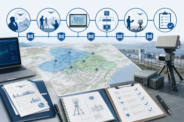
A gate-based process prevents commercial pressure from advancing an undefined technical proposal. Each gate should close a specific requirement or acceptance risk before the project proceeds; supplier ranking and final commercial selection occur only after the procurement baseline is complete.
Gate 1 — Mission approval: Approve the protected assets, target set, warning time, operating concept and legal boundary.
Gate 2 — Architecture approval: Approve sensor roles, C2 workflow, external interfaces, cybersecurity boundary and response path.
Gate 3 — Site basis approval: Approve survey inputs, sensor positions, coverage assumptions, blind zones and infrastructure.
Gate 4 — RFP readiness: Confirm that mandatory requirements, evidence schedules, interface documents and response tables are complete enough to issue consistently to all respondents.
Gate 5 — Field validation: Run the agreed trial, retain raw data and document limitations, exceptions and corrective actions.
Gate 6 — Commercial disclosure review: Confirm that every response identifies included items, exclusions, recurring charges, delivery schedule, warranty, support and responsibility boundaries. Use the separate quotation-comparison guidefor supplier scoring and evaluated project cost.
Gate 7 — Contract and acceptance: Attach the final specification, drawings, interface schedule, test plan and responsibility matrix to the contract.
Drone Detection & Low-Altitude Surveillance Radar Procurement Guide (2026)
Where This Guide Fits in the Buying Process
Use this guide after the required coverage class is understood and before final supplier offers are compared. It converts the mission into a common technical, evidence, interface, test and acceptance baseline; it does not rank suppliers or determine the best-value offer.
| Buyer Stage |
Recommended Midradar Content |
Purpose |
| Choose coverage class |
How to Choose a Low-Altitude Surveillance Radar for Industrial and Airport Sites |
Explains local, facility-wide and long-range coverage decisions |
| Define the procurement |
This guide |
Converts the mission into architecture, requirements, evidence schedules, interfaces, tests, acceptance and a common RFP response format |
| Compare final offers |
How to Compare Surveillance Radar Quotations: 15 Checks Before You Choose a Supplier |
Exclusively handles supplier normalization, commercial comparison, evaluated project cost, risk scoring and final selection |
| Review system architecture |
Integrated Counter-UAV Solution |
Shows the role of radar, RF, EO/IR, fusion, C2 and authorized response layers |
| Select candidate products |
Radar Systems / Low-Altitude Surveillance Radar / Radar Catalog |
Maps approved requirements to current product families |
Conclusion
A successful drone detection radar procurement is built around a measurable operating outcome. The buyer should define the threat and response timeline, select sensors by role, specify target-specific radar performance, freeze interfaces, complete a site survey, define required evidence, test the proposed architecture in realistic conditions and attach the acceptance method to the contract.
The result should be more than a list of equipment. It should be a procurement baseline stating what the system must detect and track, how information will be verified and integrated, which evidence and deliverables must be submitted, what limitations remain, who owns each delivery responsibility and how acceptance will be decided.
After compliant responses are received, normalize scope and compare evaluated project cost in the separate surveillance radar quotation-comparison guide.
FAQ
What is the first step in buying a drone detection radar?
Define the protected asset, representative target set, operating environment, warning time and response workflow. Product selection should begin only after these requirements are approved.
Should every project use radar, RF and EO/IR together?
No. Each sensor should have a defined operational role. Radar is useful for physical-object detection, RF adds signal context, and EO/IR supports visual confirmation. The required mix depends on the threat model, site and legal environment.
Is one maximum detection range enough for an RFP?
No. Require target-specific first detection, track initiation and stable-tracking performance with the altitude, speed, aspect, environment and test method stated.
What is the difference between a detection system and a counter-UAS system?
A detection system produces alerts and tracks. A counter-UAS system may also include threat assessment and response functions. Response authorities and restrictions vary by jurisdiction, so detection and mitigation must be specified separately.
What does radar-to-camera integration need to include?
It should include track data, coordinate conversion, time synchronization, camera control, calibration, latency, target-in-frame acceptance, health monitoring and responsibility for the camera driver and external platform.


 10:18
10:18