Drone Detection Radar: How It Works, Detection Range & How to Choose a System
Drone detection radar is the backbone sensor for 24/7 counter-UAS awareness — working through darkness, fog, and against drones flying with no radio signal. Here's how it works, what detection range actually looks like, and how Midradar's radar systems compare.
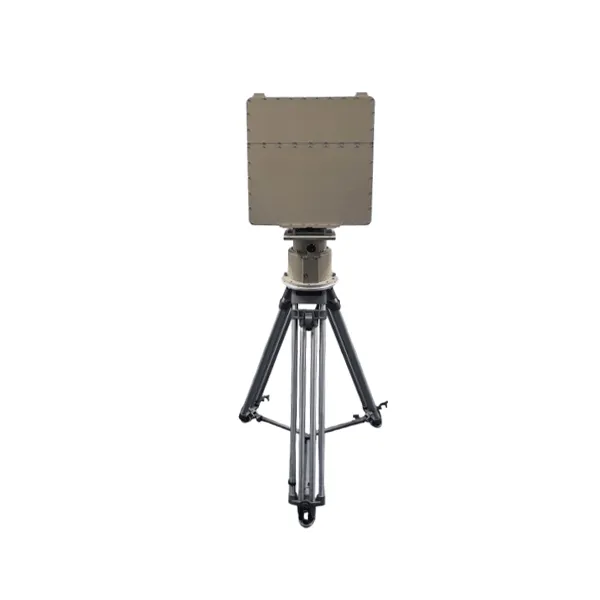
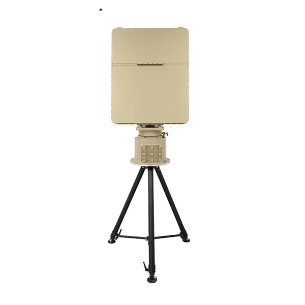
In short: Drone detection radar uses radio waves to detect, track, and classify unmanned aerial vehicles by measuring their radar cross-section (RCS), speed, and flight path. Real-world detection range depends heavily on drone size — Midradar's portable Ku-band MR-RDV05K is specified to detect a small, 0.01 m²-class consumer drone (e.g. DJI Phantom 4-class) at ≥3 km, while its long-range X-band MR-RDT18K and MR-RDT20K list ≥8 km and ≥10 km respectively against that same small-drone class — their 15 km and 20 km headline ranges apply to larger targets such as vehicles and helicopters. Actual performance depends on target RCS, altitude, line of sight, terrain or sea clutter, weather, electromagnetic conditions, and deployment geometry. Unlike RF detection, radar keeps working against drones flying in "silent mode" with no active radio transmission — making it the core sensor in airport, border, and critical-infrastructure counter-UAS systems.
How Does Drone Detection Radar Work?
Four principles explain almost everything about how a radar finds, measures, and identifies a drone.
The four-stage process behind every radar detection, from wave emission to target classification.
Why Radar Cross-Section (RCS) is the number that actually matters
A drone's RCS — roughly, how much of the radar's signal it reflects back — is the single biggest factor in detection range, more than the drone's physical size. A typical consumer quadcopter has an RCS around 0.01 m² (Midradar's own spec sheets use a DJI Phantom 4-class drone as the 0.01 m² reference point), while a passenger vehicle sits around 5 m² — 500 times larger. This is precisely why standard air-traffic control radar, tuned for aircraft-sized RCS, cannot reliably see small drones: the return signal is simply too weak relative to background clutter. Purpose-built drone detection radar solves this with higher transmit sensitivity, narrower beams, and clutter-suppression signal processing tuned specifically for small, slow, low-flying targets.
Why frequency band (X-band vs. Ku-band) changes what you should buy
Midradar's product line splits across two bands for a reason. Ku-band (used in the portable MR-RDV05K) has a shorter wavelength, which supports a smaller, lighter antenna — the trade-off is comparatively shorter maximum range, which is why this is the portable, rapid-deployment model. X-band (used in the MR-RDT18K and MR-RDT20K) trades some portability for greater range and penetration through light precipitation, which is why Midradar's longer-range, fixed/semi-fixed systems use it. Neither band is universally "better" — the right choice depends on whether the deployment prioritizes mobility or maximum coverage.
Midradar's low-altitude surveillance radars use a mechanical azimuth scan combined with elevation digital beamforming (DBF) in a continuous-wave architecture — which lowers the radar's electromagnetic signature and interception risk compared with conventional pulse radar systems, while still delivering full 360° coverage.
Drone Detection Radar Range — What Midradar's Systems Actually Achieve
Detection range isn't one number — it depends on the target's size (RCS). Here's the tiered, manufacturer-published range for each Midradar low-altitude surveillance radar.
Maximum detection range by model, shown as a symmetric coverage fan — illustrative, not to exact geographic scale. Small-UAV-specific range is typically 50–60% of the max figure (see table below).
Don't be misled by a single "max range" number. All three radars above publish range by target type rather than one headline figure — because the same radar detecting a small consumer drone versus a vehicle or helicopter can see a 3–4x difference in range. Always check the tiered numbers, not just the largest one on the spec sheet.
Verified Deployment
Real-World Result: MR-RDT20K at a Coastal Petrochemical Tank Farm
A large East Asian coastal refinery and tank storage complex deployed three MR-RDT20K radars to cover an 8+ km open perimeter that previously had no UAV detection capability at all. The radars scan the full 360° azimuth and up to 3,000 m altitude, tracking ground and aerial targets simultaneously across three overlapping coverage sectors.
8+ km
perimeter covered
3 × MR-RDT20K
radar units deployed
500
simultaneous target tracks
3
coverage sectors, zero gaps
Documented outcome: the facility gained first-ever UAV detection capability over restricted production airspace, plus a reported reduction in nuisance alarms within three months of tuning completion, per the site's internal operational review.
Radar vs. RF / EO-IR / Acoustic Detection — Which Do You Need?
Most professional counter-UAS deployments don't rely on a single sensor type.
Method
Strengths
Limitations
Typical Use
Radar
All-weather, 24/7; detects "silent" drones with no active transmission; measures range and speed
Shorter range against very small RCS targets (e.g. FPV drones) than against larger UAVs
Primary detection layer
RF detection
Can identify drone make/model and control link; lower cost
Ineffective against silent or autonomous/encrypted-link drones
Identification layer
EO/IR
Visual confirmation and evidence capture
Affected by weather/light; generally shorter range than radar
Confirmation & tracking
Acoustic
Low cost
Shortest range; sensitive to ambient noise
Supplementary sensor
Most professional counter-UAS deployments combine radar with RF and EO/IR sensors rather than relying on one alone — exactly the approach used in the petrochemical case study above, where MR-RDT20K radar cued MR-HTVC12035-2132 thermal cameras for visual verification of every detected target. Midradar's MR-AUS Counter-UAV System series integrates radar and RF detection with response capability in a single platform for sites with response authorization.
How the fusion actually runs, step by step
This is the real six-step radar-video fusion workflow used in Midradar's petrochemical deployment above — not a generic diagram, but the actual sequence the platform executes for every detected target:
1
Detection
Radar continuously scans 360° azimuth and altitude, monitoring ground and low-altitude airspace simultaneously.
2
Calculation
The platform computes each target's position, speed, altitude, and projected trajectory in real time.
3
Zone Trigger
If a target's path intersects a configured alert zone, that zone's alarm rule fires automatically.
4
EO/IR Linkage
The nearest thermal/PTZ camera automatically slews to the target's coordinates and begins tracking.
5
Verification
Operators see the radar track and thermal/visible video together on one display for immediate confirmation.
6
Alarm Handling
Each event logs a complete evidence package: snapshot, video, radar track, coordinates, classification, threat score.
Who Uses Drone Detection Radar?
Application scenarios drawn directly from Midradar's deployed radar use cases.
Aviation
Airport Bird & Drone Detection
Continuous low-altitude monitoring around runways and approach paths, coordinated with EO tracking for verification.
Border & Perimeter
Perimeter & Border Protection
Wide-area 360° coverage for critical sites and border checkpoints, with radar-EO cueing to reduce false alarms.
Petrochemical
Petrochemical & Critical Infrastructure
Verified in production: an 8+ km tank-farm perimeter now covered by three MR-RDT20K radars, adding UAV detection where none existed before.
Maritime
Radar-EO Coordinated Maritime UAV Tracking
Surface and low-altitude target surveillance for ports and coastal facilities, including small-vessel detection.
Mobility
Vehicle-Mounted Deployment
Lightweight, modular radar units built for rapid, mobile, or temporary-mission deployment.
Response
Integrated Counter-UAV System
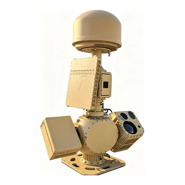
Where response is authorized, radar detection feeds directly into an integrated detect-track-respond system.
How to Choose a Drone Detection Radar System
A practical checklist before you request a quote.
Protection radius & terrain — open terrain behaves very differently from urban or mountainous clutter environments.
Minimum target size — consumer-grade drones, industrial UAVs, and small FPV drones need different sensitivity levels.
All-weather & mobility requirements — fixed installation vs. vehicle-mounted or rapid-deployment portable units.
Update-rate requirements — low-speed monitoring vs. high-refresh tracking for interception guidance.
Open interfaces — ability to cue RF, EO/IR, and response systems via standard communication protocols.
Hazardous-area / certification requirements — sites with explosive-atmosphere zones (as in the petrochemical case above) need equipment reviewed against the site's hazardous-area classification before procurement.
Realistic deployment timeline — the petrochemical case above ran 18 months end-to-end (10 months construction, 8 months operational tuning) for an 8+ km boundary — a useful planning baseline for similarly complex sites.
After-sales support — Midradar covers every product with a manufacturing-defect warranty (extended options available), field engineer installation and commissioning, structured operator training, flexible maintenance contracts, and lifetime technical support after the warranty period ends.
Midradar's Drone Detection Radar Solutions
From standalone detection radar to a fully integrated counter-UAV system.
Standalone Radar · Portable
MR-RDV05K
5 km max range · 12 kg portable
Portable Ku-band radar for rapid deployment — ideal for temporary missions, single-point perimeters, and small-to-mid-size sites.
Can radar detect small consumer drones like DJI models?
Yes. Midradar's Ku-band MR-RDV05K, for example, is rated to detect a DJI Phantom 4-class drone (RCS 0.01 m²) at up to 3 km, with longer-range X-band systems reaching 8–10 km against the same target class.
What is the typical detection range of a drone detection radar?
It depends on the radar and target size. Midradar's product range spans 5 km (portable MR-RDV05K) to 20 km (MR-RDT20K) maximum detection range, with small-drone-specific range typically 50–60% of the rated maximum range (e.g. MR-RDT20K: ≥10 km against a small drone vs. 20 km against a vehicle-sized target).
Does drone detection radar work at night or in bad weather?
Radar can operate day and night and does not depend on visible light, which is why it's used as the primary sensor for 24/7 perimeter and airspace monitoring. However, actual detection performance can still be affected by heavy precipitation, terrain or sea clutter, electromagnetic interference, line-of-sight obstructions, installation height, and target characteristics — a site survey and acceptance testing are essential to confirm real-world performance for a given location.
Can drone detection radar tell the difference between a drone and a bird?
Modern systems use clutter-suppression and tracking algorithms, combined with RCS and velocity-profile analysis, to distinguish drones from birds, vehicles, and other moving objects — reducing false alarms compared to older radar-only systems.
Buying & Deployment (from a real project)
Can cameras alone cover a large perimeter instead of radar?
Not reliably at scale. As documented in Midradar's petrochemical tank-farm deployment, covering an 8 km perimeter with cameras alone would require either a very large number of fixed units or continuous manual PTZ operation — neither gives autonomous early warning. A single radar scanning the full 360° azimuth detects and tracks multiple targets across the whole perimeter, with cameras providing visual verification for targets the radar has already located.
Do I need radar alone, or radar plus RF/EO-IR sensors?
Most professional counter-UAS deployments combine radar for all-weather detection with RF and EO/IR sensors for identification and visual confirmation — Midradar's MR-AUS series integrates radar and RF detection with response capability in a single system for sites with response authorization.
How long does a radar perimeter project typically take to commission?
It varies by site complexity. Midradar's 8+ km petrochemical tank-farm deployment ran 18 months total — 10 months of construction and installation, followed by 8 months of operational tuning to calibrate alarm thresholds against real conditions before formal handover. Smaller or single-radar sites are typically much faster.
How much does a drone detection radar system cost?
Pricing depends on detection range, coverage area, and whether you need a standalone detection radar or a full integrated counter-UAV system. Contact Midradar for a configuration matched to your site's threat profile and budget.
Ready to Discuss Your Drone Detection Requirements?
Tell us about your site, and our engineering team will recommend the right radar — or a full detect-and-respond system.