A radar that can see ships is not automatically a coastal surveillance radar.
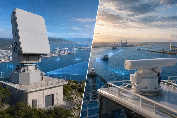
This distinction matters when a port, terminal or coastal facility evaluates radar equipment. Shipborne marine navigation radar and shore-based surveillance radar may operate in similar frequency bands and may both detect vessels, but they are designed around different operational questions.
A navigation radar primarily supports: “How can this vessel navigate safely among surrounding objects?”
A coastal surveillance system is expected to answer a different question: “What is moving across the monitored area, can the system maintain a reliable track, and can that information be used by other sensors and command systems?”
For buyers, the practical differences appear in target tracking, clutter handling, installation, interfaces, surveillance zones and acceptance testing.
Coastal Surveillance Radar vs. Marine Navigation Radar: A Buyer’s Guide for Ports and Coastal Sites
Mission Comes Before Radar Specifications
The first procurement decision should not be frequency band, output power or maximum range. It should be the mission.
| requisito |
Marine Navigation Radar |
Coastal Surveillance Radar |
| Primary purpose |
Safe vessel navigation |
Persistent area surveillance |
| Instalação típica |
Onboard vessel |
Tower, rooftop, port or coastline |
| Operator focus |
Vessel-centric situational awareness |
Area-centric target monitoring |
| Persistent track management |
Navigation-oriented |
Usually a core requirement |
| Restricted/security zones |
Limited or application-dependent |
Common requirement |
| EO/IR camera cueing |
Usually not primary |
Often required |
| C2/VMS integration |
Navigation-system dependent |
Frequently important |
| Multi-site networking |
Not primary design objective |
Common in large projects |
| Operação autônoma |
Application-dependent |
Often expected |
| Site-specific coverage engineering |
Limitado |
Essencial |
This is why comparing only detection range can lead to the wrong equipment selection.
Detection Range Is Not the Same as Useful Surveillance Range
A port may receive two proposals that both state a 20 km or 30 km detection range. That does not mean the systems will provide the same surveillance performance.
A buyer should distinguish at least three operational questions:
- First detection: when does the target first become visible?
- Stable tracking: from what distance can the system maintain a usable track?
- Operational identification or verification: when can another sensor or operator confirm what the target is?
For a small boat close to sea clutter or shoreline structures, the stable tracking range can be more important than the maximum first-detection distance.
A professional proposal should therefore define the test target and conditions behind a range claim.

Coastal Surveillance Radar vs. Marine Navigation Radar: A Buyer’s Guide for Ports and Coastal Sites
Port Environments Are More Difficult Than Open Water
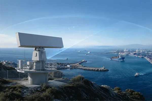
A coastline is rarely a clean radar scene. Ports can contain:
- container cranes
- moored vessels
- breakwaters
- warehouse buildings
- vehicles
- metallic structures
- waves and sea clutter
- shoreline multipath
The result is a mixed land-water environment in which the radar must separate relevant targets from a large amount of background energy and legitimate traffic.
This is one reason why a radar that performs adequately for navigation offshore should not automatically be assumed to provide equivalent performance in a busy terminal.
What Should the Radar Track?
A coastal project should define target classes before discussing radar quantity.
| Alvo |
Questions the Buyer Should Define |
| Small boat |
Size, speed, expected sea state |
| Workboat |
Typical route and operating zone |
| Fishing vessel |
Cooperative/non-cooperative monitoring requirements |
| Large commercial vessel |
Required track continuity |
| Vehicle near shoreline |
Whether land targets are in scope |
| Pessoal |
Whether the radar is expected to support ground surveillance |
This forces suppliers to respond to a measurable requirement instead of quoting one maximum-range number.
Coastal Surveillance Radar vs. Marine Navigation Radar: A Buyer’s Guide for Ports and Coastal Sites
AIS and Radar Are Complementary
AIS provides valuable identity and navigation information from cooperative vessels. Radar observes physical targets within its sensing capability. These are not interchangeable.
In a port surveillance architecture, a useful operating picture may combine: Radar track + AIS identity + EO/IR image + map/geofence + operator event record.
If the radar system is intended to operate inside an existing VTS or security platform, interface design should be assessed early in the project.
Integration Is Often the Real Differentiator
A shore-based surveillance radar may need to exchange data with sistemas EO/IR, PTUs, AIS receivers, VMS, GIS platforms, security C2 and event-recording systems.
| Interface Item |
What to Verify |
| Dados da faixa |
Position, speed, heading, track ID |
| Coordenadas |
Reference system and conversion |
| Tempo |
Timestamp and synchronization |
| Network |
Ethernet/interface architecture |
| Health status |
Radar and subsystem status |
| Alarm zones |
Geofence/event logic |
| EO/IR sinalizando |
Slew-to-cue capability and latency |
| API/SDK |
Availability and disclosure boundary |
A radar that cannot integrate efficiently may create significantly more project cost than its purchase price suggests.
Shore Installation Creates Different Engineering Risks
A coastal radar may be mounted on a tower for years of continuous exposure. This creates requirements that are less obvious in a product comparison: wind load, salt corrosion, lightning, grounding, maintenance access, network redundancy and power quality.
The installation system should therefore be evaluated as one complete sensor node rather than as a radar enclosure alone.
Track Quality, Update Rate and Handover Matter
For persistent surveillance, a target track is useful only if it remains sufficiently stable for an operator or another sensor to act on it. Buyers should therefore ask how often tracks are updated, how track confidence is represented, what happens during temporary masking, and how quickly a reacquired target receives its previous or a new track identity.
This becomes especially important when the radar cues EO/IR. A camera can only use radar data effectively if the coordinate quality, update rate and end-to-end latency are suitable for the camera field of view and acquisition process. “Radar supports camera linkage” is therefore not a complete interface requirement; the buyer should define the handover workflow and verify it during SAT.
Standards Context: Navigation Radar Is a Defined Shipborne Category
Shipborne navigation radar is not merely a marketing category. IMO Resolution MSC.192(79) defines revised performance standards for radar equipment, and IEC 62388:2013 specifies minimum operational/performance requirements, test methods and required test results for shipborne radar conforming to performance standards not inferior to those adopted by IMO. These references help explain why navigation radar requirements are centered on safe navigation and shipborne operation.
A shore-based coastal surveillance project may use different equipment architectures and additional functions. Buyers should therefore avoid treating compliance with a shipborne navigation-radar standard as evidence that every shore-surveillance requirement—such as security zones, EO/IR cueing or multi-site C2 integration—has automatically been met.
Site Placement Can Change More Than the Datasheet
Radar height, shoreline geometry and nearby structures directly affect the operational picture. A higher position can improve horizon and reduce some local obstructions, but may also increase wind-loading, structural and maintenance requirements. Conversely, a low installation close to breakwaters or cranes can create masking and strong local clutter. The proposal should therefore include a site-specific placement rationale rather than only a sensor range circle.
A Better Way to Write the RFQ
Weak requirement: “Required detection range: 30 km.”
Better requirement: ?The supplier shall state first-detection and stable-track performance for defined surface targets under stated installation height and environmental conditions, including sea-clutter assumptions.? For bid-language structure, use the radar system RFI/RFP guide.
This wording makes supplier proposals easier to compare. After compliant offers are received, comparar cotações de radares de vigilância on the same target and environment basis.
What Evidence Should Be Requested Before Purchase?
For a serious port project, the supplier response should be traceable to test conditions. Request representative target definitions, installation height, clutter/sea-state assumptions, track-update information, interface documentation, environmental conditions and the proposed FAT/SAT method. Where a live demonstration is used, the buyer should record target routes, speeds and environmental conditions so that competing systems can be compared consistently.
A useful SAT should test more than one pass of a large vessel. For acceptance planning, use the guia de teste de campo e aceitação de radar. It can include a representative small craft, approach and departure routes, shoreline/clutter sectors, track continuity, alarm-zone logic, AIS association where included, radar-to-EO/IR cueing and data delivery to the operational platform.
Procurement Checklist
- Define target classes, minimum relevant target size and speed range.
- Define first-detection and stable-track expectations separately.
- Provide installation height, coastline/terminal geometry and known obstructions.
- Specify AIS, EO/IR, C2/VTS and track-data interface requirements.
- Specify environmental, maintenance, redundancy and SAT requirements.
Buyer Decision Rule
Choose a marine navigation radar when the dominant task is navigation.
Evaluate a dedicated surveillance solution when the project requires a combination of persistent tracks, surveillance zones, shore installation, sensor integration, C2/VTS connectivity and unattended monitoring.
The mission should determine the radar architecture—not the other way around.
Perguntas Frequentes
Can a marine navigation radar be used for shore surveillance?
In some applications, yes. But the buyer should verify whether its tracking, integration and clutter performance meet the actual shore-surveillance requirement.
Is a longer maximum range always better?
No. Stable tracking, small-target conditions, sea state, installation height and clutter are equally important.
Can AIS replace radar?
No. AIS is cooperative information. Radar provides physical sensing of targets within its detection capability.



 10:43
10:43