Securing a national border is a different engineering problem from protecting a single facility. A power plant, airport or industrial site usually has a defined perimeter and a relatively stable operating environment. A national frontier may extend across hundreds of kilometers of desert, mountain, river or coastline, with large variations in terrain, communications, power availability and target behavior.
The procurement challenge is therefore not simply to identify the radar with the longest advertised range. It is to determine whether a proposed sensor network can detect the relevant target classes, control nuisance alarms, operate unattended, integrate with the command structure and expand in phases without creating an unsustainable operating burden.
This guide is designed for government technical teams, system integrators, project consultants and procurement personnel who are defining requirements or shortlisting suppliers. It explains the questions that should be answered before detailed system design begins.
Border Security Radar Systems: A Buyer’s Guide for Land and Coastal Borders
1. Why Border Security Is a Different Procurement Problem
Perimeter protection radar e ground surveillance radar use related sensing principles, but a border deployment imposes a different combination of scale, terrain and operating constraints.
- A border deployment is rarely one radar. It is normally a chain of overlapping sensor zones, often tied into a common operational picture.
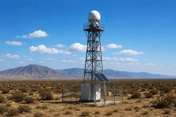
- Terrain variability. One border section may cross open desert, vegetation, mountain passes, riverbanks and coastal landing areas. Each zone may require a different sensor type, mounting height and node spacing.
- Multiple target classes. The system may need to detect personnel, vehicles, small vessels and, in selected sectors, low-altitude airborne targets.
- Remote operation. Many sites are unattended. Reliability, remote health monitoring, maintainability and manageable false-alarm levels are therefore central procurement issues.
- Phased funding and deployment. Large programs are normally built in sections. A pilot must be capable of becoming part of the final architecture rather than a stand-alone demonstration.
A credible evaluation should begin with these operating realities, not with a generic comparison of maximum range, antenna size or frequency band.
2. Define the Operational Requirement Before Comparing Products
Radar proposals cannot be compared meaningfully until the protected section and operational objective are defined. The initial requirement does not need to be a complete tender specification, but it should give each supplier the same baseline.
| Requirement input |
Questions to define |
| Border section |
What length is included in the pilot and in the eventual full deployment? |
| Terrain |
Is the sector open desert, mountain, vegetated, river, coastal or mixed? |
| Target classes |
Personnel, vehicle, vessel, UAV or a defined combination? |
| Warning objective |
What response time is required before the target reaches a road, crossing point or protected zone? |
| Operating concept |
Will every alarm be visually confirmed? Which patrol or response unit receives the event? |
| Existing systems |
Is there an established C2, VMS, GIS, EO/IR network or communications backbone? |
| Deployment model |
Pilot section, phased expansion or immediate full-zone deployment? |
This information determines the appropriate sensor mix, number of nodes, overlap strategy and level of system integration. Without it, suppliers may quote different interpretations of the project and produce proposals that appear comparable but are not.
Border Security Radar Systems: A Buyer’s Guide for Land and Coastal Borders
3. Five Criteria That Matter More Than Headline Detection Range
Maximum detection range is easy to place in a comparison table, but it is also the figure most likely to mislead when it is separated from the target, terrain and performance criterion.
3.1 Target-specific detection performance
Ask for performance against the actual operational targets: a walking or crawling person, a passenger vehicle, a truck, or a small vessel in a coastal sector. Published range may be based on a larger target in open terrain. It may also refer to an isolated detection rather than a stable track.
The proposal should distinguish first detection, track initiation and sustained tracking, and should identify the test target, aspect, speed, terrain and environmental conditions. A single best-case range figure is not enough for procurement.
3.2 False alarms under representative terrain conditions
Open terrain contains many sources of nuisance alerts: moving vegetation, wildlife, wind-blown debris, sand, rain and, near the coast, sea clutter and wave motion. A system that performs well during a short demonstration can still create an unmanageable operational workload over weeks of unattended use.
AI-assisted classification is increasingly used to help operators separate personnel and vehicles from environmental clutter, but the buyer should request evidence from a comparable site and should verify how unclassified or low-confidence tracks are handled. Classification should support the operator; it should not be treated as a substitute for a realistic false-alarm assessment.
3.3 Environmental survivability and maintainability
An IP rating is only one part of environmental suitability. Desert sites may require resistance to high temperature, dust ingress and thermal cycling. Coastal sites introduce salt-air corrosion. Mountain sites may introduce icing, wind and difficult maintenance access.
The evaluation should cover operating and storage temperatures, cold start, wind loading, corrosion protection, lightning and surge protection, remote diagnostics, replacement intervals and the logistics of servicing isolated nodes.
3.4 Integration with the command-and-control environment
A radar chain is useful only when its tracks, alarms and health status are available to the operational system. Buyers should confirm the data interfaces required for C2, VMS, GIS, third-party sensor fusion and fusão radar-visão.
Open or documented interfaces reduce the risk of becoming dependent on a closed platform and make it easier to add electro-optical confirmation, additional radar types or analytics during later phases. The supplier should define what data are exposed, how timestamps are managed and whether third-party integration is supported through a documented API or protocol.
Border Security Radar Systems: A Buyer’s Guide for Land and Coastal Borders
3.5 Modularity and phased deployment
Very few border programs are funded, installed and accepted as a single step. A practical architecture allows a pilot sector to validate target performance, node spacing, communications and operator workload before the system expands along the frontier.
The pilot should use the same interfaces, data model and command architecture intended for the final system. Otherwise, the pilot may prove a local sensor while creating additional integration work when the program scales.
4. Match the Radar Type to the Border Geography
A mixed border should not be forced into a one-radar solution. The sensor should be selected by zone and target class, then unified through the command platform.
| Border scenario |
Primary sensor need |
Typical priority |
| Open land border: desert or plains |
Long-range ground-surveillance radar |
Personnel and vehicles with early warning across open terrain |
| Coastal or maritime border |
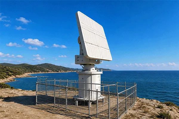
Surface-surveillance radar plus land sensors near landing points |
Small vessels offshore and personnel at the shoreline |
| Mountainous or mixed terrain |
More short- or medium-range nodes with overlapping fields of view |
Personnel and vehicles where terrain blocks long line of sight |
| High-value crossing point |
Radar integrated with EO/IR |
Positive visual verification and evidential recording |
| Selected low-altitude sector |
Low-altitude surveillance radar integrated with the ground network |
Small UAVs or low-flying targets where the threat assessment requires it |
Coastal sectors typically require a dedicated radar de vigilância de superfície capability rather than relying on a land-optimized sensor to provide reliable small-vessel coverage. Likewise, a radar de vigilância de baixa altitude should be introduced only where the threat definition includes airborne targets.
Terrain also determines how many nodes are required. Published range is not the same as effective coverage radius. Mountain ridges, vegetation, buildings and the curvature of the earth can create blind zones. Node spacing should therefore be based on line-of-sight analysis, representative target height, overlap requirements and required warning time.
5. From Individual Radar Nodes to an Operational System
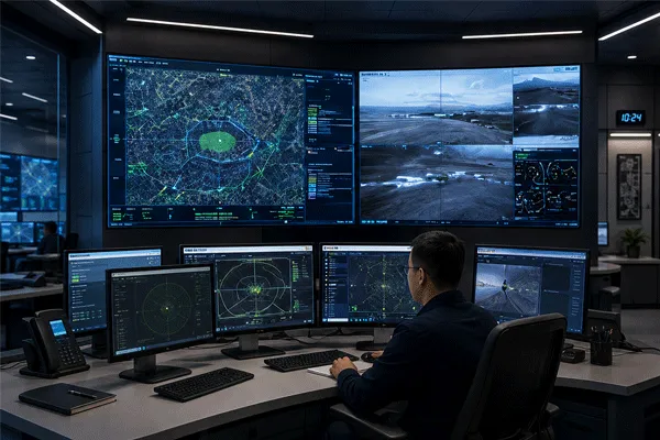
A border-surveillance project is a system of systems. Radar supplies wide-area detection and tracking, but the operational result depends on how the track is fused, verified, displayed and passed to the response organization.
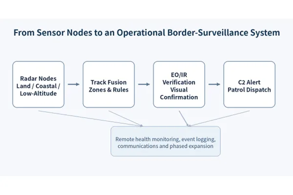
The buyer should evaluate the complete detection-to-response chain, not the radar node in isolation
For early-stage procurement, the purpose of this architecture is not to define every communications or cybersecurity parameter. It is to confirm that the proposed radar can become part of an operational chain: track generation, rule-based alerting, EO/IR verification, C2 presentation, patrol dispatch, event recording and remote health monitoring.
6. Vendor Shortlisting Checklist
Before selecting suppliers for a detailed technical workshop or pilot, request a consistent response to the following items:
- Detection and tracking performance separated by target type: personnel, vehicle and, where relevant, vessel or UAV.
- The test conditions behind each performance figure, including terrain, target speed, aspect and environmental conditions.
- False-alarm and classification evidence from a comparable operating environment, not only a controlled laboratory or short demonstration.
- A preliminary coverage model showing line-of-sight limits, overlap and proposed node spacing.
- Environmental qualification relevant to the project climate and an explanation of maintenance requirements for remote sites.
- Documented interfaces for the existing or planned C2, VMS, GIS and EO/IR environment.
- A pilot and phased-expansion plan that uses the same architecture intended for the full deployment.
- Remote health monitoring, fault reporting, software update and log-retention capabilities.
- Lead times, training, spare-parts strategy and local or regional support arrangements.
- A proposed method for factory testing, site acceptance and performance validation against representative targets.
This checklist is designed for supplier shortlisting. Detailed acceptance thresholds should be developed after the project team has selected the pilot sector, target set and operational response concept.
Border Security Radar Systems: A Buyer’s Guide for Land and Coastal Borders
7. Where Midradar Fits
Midradar develops radar, electro-optical and sensor-fusion products for wide-area surveillance. For border projects, the portfolio can be evaluated as a combination of ground, surface and low-altitude sensing rather than as a single universal radar type.
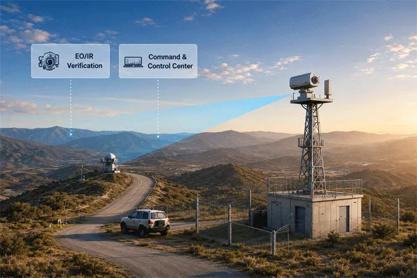
A proposed system can be structured by terrain zone: ground-surveillance sensing for open land approaches, surface-surveillance sensing for coastal or river sectors, and EO/IR verification at high-value routes and crossing points. Where the project requires an airborne layer, low-altitude radar can be integrated into the same operational picture.
Specific target ranges, classification functions, environmental limits and third-party interfaces should be confirmed against the current product configuration and the project requirement. Midradar recommends beginning with a defined pilot sector so that coverage, alarm quality, integration and maintenance assumptions can be validated before the architecture is extended.
FAQ
What is the difference between border security radar and perimeter protection radar?
Perimeter protection radar is normally optimized for a single fixed site. Border-surveillance systems must address longer coverage distances, multiple nodes, changing terrain, unattended operation and, in coastal sectors, different target classes such as small vessels.
How many radar nodes are needed for a border section?
The number depends on terrain masking, target type, required warning time, installation height, overlap and redundancy. Mountainous or vegetated terrain generally requires more nodes than open desert. A coverage model should be completed before equipment quantity is fixed.
Can one radar type cover both land and coastal targets?
A single sensor may provide useful coverage in a limited mixed zone, but land and maritime environments create different clutter and target conditions. Coastal borders normally benefit from dedicated surface-surveillance sensing integrated with ground radar at landing points.
Should a border program start with a pilot?
A pilot is usually the lower-risk approach when the terrain, target performance or integration workload has not been validated. The pilot should represent a real operating sector and should use the architecture, interfaces and support model intended for later expansion.
What information should be provided before a technical discussion?
Provide the approximate section length, terrain type, target classes, required warning objective, available installation locations, existing command platform and intended deployment phase. This is enough to begin a structured sensor and pilot review without turning the first discussion into a full system-design exercise.














 10:20
10:20