


MR-RDT02K Radar di sorveglianza a bassa quota
Radar 3D di sorveglianza a bassa quota per il rilevamento e il tracciamento continui di droni, aeromobili, uccelli, persone, veicoli e imbarcazioni in aria, a terra e sull'acqua.

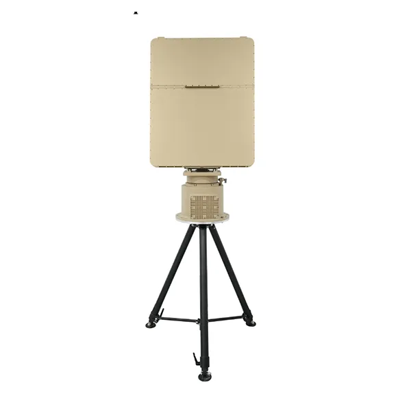


The MR-RDT20K Low-Altitude Surveillance Radar is an X-band moving-target surveillance radar designed for continuous, all-weather detection and tracking of low-altitude moving targets. The radar adopts mechanical azimuth scanning combined with elevation digital beam forming (DBF), providing full 360° azimuth coverage and an elevation field of view from -5° to 60°. With an instrumented range of 20 km, the MR-RDT20K can detect small rotary-wing UAVs with an RCS of 0.01 m² at distances of 10 km or more, while targets with an RCS of 1 m² can be detected at distances of 20 km or more. The radar supports simultaneous tracking of at least 500 targets and provides accurate measurement of target range, velocity, azimuth and elevation for large-area low-altitude surveillance applications.
Preventivo gratuitoThe MR-RDT20K is a long-range three-dimensional low-altitude surveillance radar based on mechanical azimuth scanning and elevation digital beam forming technology.
Mechanical azimuth scanning provides continuous 360° horizontal surveillance, while elevation DBF enables accurate height measurement across an elevation coverage range from -5° to 60°.
Advanced signal processing, clutter suppression and target tracking algorithms enable reliable detection and accurate measurement of target range, velocity, azimuth and elevation in complex low-altitude environments.
The radar provides a maximum instrumented range of 20 km, a maximum detection altitude of 3000 m, and simultaneous tracking capacity of at least 500 targets.
Selectable antenna rotation speeds and configurable target update intervals allow the MR-RDT20K to support wide-area surveillance tasks requiring high target capacity and continuous tracking performance.
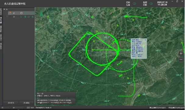
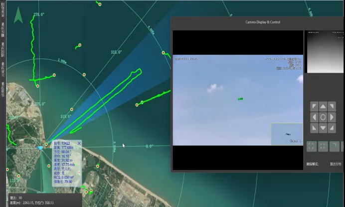
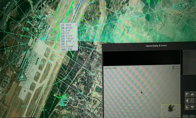
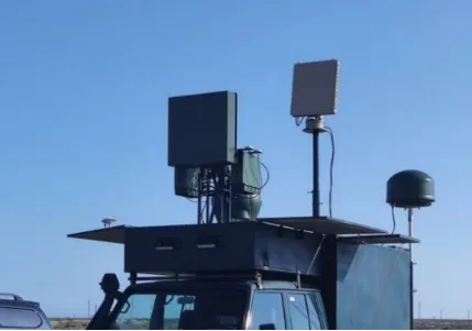
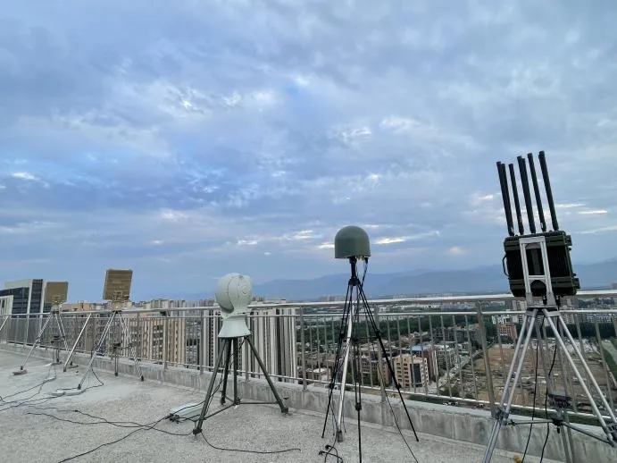
Rilevamento Ampia Area ad Alta Capacità
Mechanical azimuth scanning combined with elevation DBF enables continuous 360° surveillance and real-time detection and tracking of multiple moving targets across large operational areas.
Elevata precisione di rilevamento
Advanced signal processing algorithms and system hardware architecture provide accurate measurement of target range, velocity, azimuth and elevation.
Alta Frequenza di Aggiornamento e Tracciamento Preciso
Selectable antenna rotation speeds and advanced tracking algorithms improve tracking performance for high-speed and maneuvering targets.
High Detection Sensitivity and Low False Alarm Rate
Advanced clutter suppression technology enables reliable detection of weak moving targets under strong ground clutter, weather clutter and other complex background conditions.
Strong Clutter Suppression
High clutter visibility supports stable detection and tracking of ultra-low-altitude targets in complex urban and terrain environments.
Bassa firma elettromagnetica
The continuous-wave operating architecture uses relatively low transmission power, helping reduce electromagnetic interception risk compared with conventional pulse radar systems.
Easy Operation and Rapid Deployment
An intelligent human-machine interface and modular radar architecture support simple operation, installation and relocation.

| Parametro | Specifiche |
|---|---|
| Modello | MR-RDT20K |
| Banda operativa | Banda X |
| Architettura del radar | Scansione Azimut Meccanica DBF Elevazione |
| Instrumented Range | 50 m – 20 km |
| Altitudine massima di rilevamento | 3000 m |
| Copertura dell'azimut | 360 |
| Copertura in altitudine | -5° to 60° |
| Gamma di Velocità Radiale | 1 C150 m/s |
| Portata di rilevamento dei piccoli UAV | ≥10 km, RCS = 0.01 m² |
| RCS 1 m² Target Detection Range | ≥20 km |
| Vehicle / Helicopter Detection Range | ≥20 km |
| Precisione della gittata | ≤5 m RMS |
| Accuratezza della velocità | ≤0.5 m/s RMS |
| Precisione Azimutale | ≤0.3° RMS |
| Precisione in Elevazione | ≤0.3° RMS |
| Target Update Interval | 2 s standard; 1 s / 3 s optional |
| Velocità di Rotazione dell’Antennа | 30 RPM standard; 20 / 60 RPM optional |
| Capacità di tracciamento simultaneo | Obiettivi ≥500 |
| Temperatura di funzionamento | -40°C a +55°C |
| Valutazione di protezione | IP66; Radar Host IP67 |
| Alimentatore | DC 36–52 V, with AC220V-to-DC48V adapter |
| Consumo energetico | ≤400 W |
| Interfaccia di comunicazione | Gigabit Ethernet aviation connector |
| Radar Host Dimensions | To be confirmed |
| Radar + Turntable Weight | ≤55 kg |
| Voce | Dimensioni (mm) | Peso (kg) | Dim. imballata (mm) | Peso imballato (kg) |
| Unità Host | ≤655*815*116 | ≤25 | ≤930*760*220 | ≤40 |
| Basamento | ≤520*Φ380 | ≤27 | ≤430*510*610 | ≤40 |
| Treppiede | ≤1100*450*450 | ≤20 | ≤1100*450*450 | ≤23 |

| No | Nome | Quantità | Unità | Descrizione |
| 1 | Unità host radar | 1 | Unità | |
| 2 | Basamento Radar | 1 | Unità | |
| 3 | Treppiede | 1 | Unità | |
| 4 | Custodia di Trasporto Unità Principale Radar | 1 | Unità | Custodia per il trasporto in lega di alluminio |
| 5 | Custodia di Trasporto Piatto Radar | 1 | Unità | Custodia per il trasporto in lega di alluminio |
| 6 | Adattatore di alimentazione | 1 | Cavo | AC220V a DC48V, Lunghezza 15m |
| 7 | Cavo di comunicazione | 1 | Cavo | Collega il radar al terminale di visualizzazione e controllo, lunghezza 15 m |
| 8 | Strumenti di montaggio e viti | 1 | Set | Per il montaggio di host, piedistallo e treppiede |
| 9 | Documento | 1 | Copia | Manuale d'uso, ecc. (versione elettronica) |
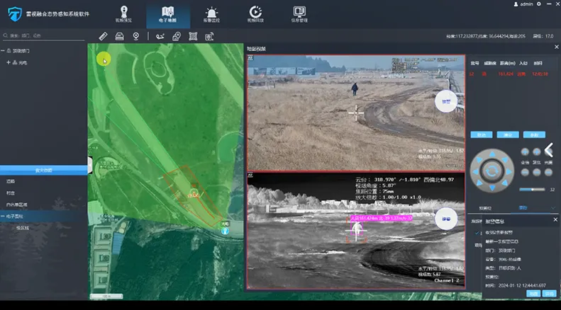
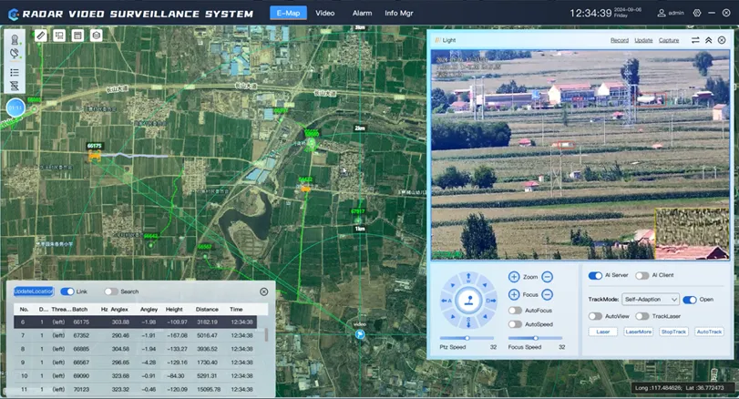
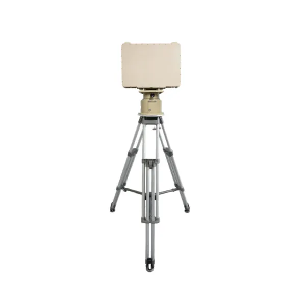
Radar 3D di sorveglianza a bassa quota per il rilevamento e il tracciamento continui di droni, aeromobili, uccelli, persone, veicoli e imbarcazioni in aria, a terra e sull'acqua.
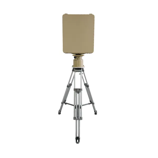
Progettato per il rilevamento e il tracciamento affidabile di obiettivi a bassa quota in ambienti complessi, ideale per il monitoraggio degli UAV, la sicurezza delle frontiere e la protezione delle infrastrutture critiche.
Progettato per il rilevamento a lungo raggio a bassa quota e il tracciamento di più bersagli, ideale per il monitoraggio degli UAV, la sicurezza delle frontiere e i sistemi di sorveglianza di grandi aree.
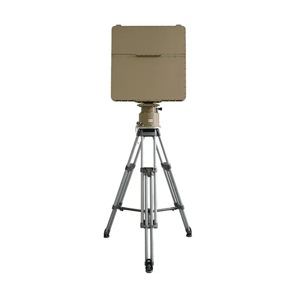
Progettato per il rilevamento a lungo raggio a bassa quota e l'inseguimento multi-obiettivo ad alta capacità, è adatto alla sorveglianza di grandi aree e ai sistemi avanzati di contro-UAV.

Contattateci e vi risponderemo al più presto.
Ti risponderemo entro 24 ore. In caso urgente, si prega di aggiungere WhatsApp/WeChat: 86 86 13361376820. Oppure chiamare direttamente 86 86 13361376820.
*Rispettiamo la tua riservatezza e proteggiamo tutte le informazioni.
Utilizzeremo i tuoi dati esclusivamente per rispondere alla richiesta e non invieremo mai e-mail non richieste o messaggi promozionali.