The “10 km Radar” Reality Gap
On paper, industrial radar performance looks precise and guaranteed. Manufacturers often tout impressive specifications: a 10 km detection range, the ability to spot a 0.01 m² target, and “all-weather” operation. However, in real-world deployments, these numbers rarely hold true.
This isn’t necessarily because the radar is “bad.” It’s because the environment never behaves like a controlled laboratory. Whether it’s a tropical rainstorm in Southeast Asia, sand and dust in the Middle East, or thermal drift in the Arctic, environmental physics can cause a single radar system to perform 30%–60% differently depending on where it is installed.
The Three Recurring Issues in Global Radar Deployment
Most radar system failures happen after procurement because the gap between “rated range” and “operational range” is not fully understood.
1. Rated Range vs. Operational Range
Datasheet values assume ideal “free-space” conditions. In reality, performance is significantly reduced by:
- Atmospheric Attenuation: Rain, humidity, and fog absorb RF energy.
- Multipath Reflections: Signals bouncing off the ground or nearby structures create interference.
- System Losses ($L_{sys}$): Energy lost through the radome and internal processing chains.
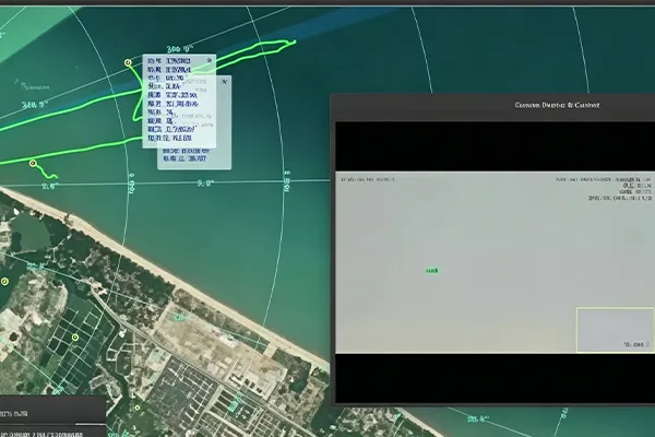
2. Detection is Not Stable Tracking
A system might “detect” a target (show a blip), but fail to provide a stable track. This leads to:
- Unstable target trails.
- PTZ camera misalignment.
- Frequent false alarms in cluttered environments.
The root cause is often insufficient Signal-to-Noise Ratio (SNR) and angular measurement instability.
3. The Fluctuation of UAV RCS
Small drones are dynamic targets. Their Radar Cross Section (RCS) fluctuates constantly due to changes in orientation and propeller rotation (micro-Doppler effects). A target that is “detectable on paper” may become intermittent or invisible in the field.
How Midradar Solves the Deployment Challenge
At Midradar, we don’t just sell hardware; we provide predictive deployment intelligence. We start by asking: Where will it be deployed? What are the local physics?
Modeling Real Operational Conditions
Our risk intelligence system reconstructs your environment using three physical layers:
- Atmospheric Propagation (ITU-R P.838): We simulate how heavy rainfall or dust scattering impacts Ku/X band systems. In tropical regions, signal attenuation can reach 5–15 dB per kilometer.
- Expanded Radar Equation: We include real-world factors like receiver noise figures, pulse integration gain, and radome degradation.
- Dynamic Target Behavior: We model UAV rotor micro-Doppler signatures and random motion patterns of bird flocks to ensure stable tracking.
Reality vs. Specification: A Comparison
| Parameter |
Datasheet Specification |
Real-World Deployment |
| Detection Range |
10 km |
5–7 km (Environment dependent) |
| Target RCS |
Fixed Value |
Highly Dynamic |
| Clutter Environment |
Clean/Ideal |
Multipath + Rain + Terrain |
| Tracking Stability |
Ideal |
SNR-limited in the field |
Why AESA Radar Performs Better in Complex Environments
Traditional mechanically scanned radars often struggle with slow scan rates and mechanical wear. In contrast, AESA (Active Electronically Scanned Array) systems offer:
- Spatial Beam Control: Real-time suppression of interference and clutter.
- Multi-target Parallel Tracking: Simultaneous tracking of multiple threats without scan delays.
- Digital Beamforming (DBF): Adaptive optimization of signal paths to maintain high SNR.
For high-stakes scenarios like airport perimeter defense or border security, AESA technology provides the reliability that standard systems lack.
Get Your Site-Specific Radar Risk Analysis
Radar selection should not be a simple comparison of datasheets. It is a physics problem: How much of your system performance will survive real-world conditions?
Midradar helps you avoid expensive deployment failures by providing a structured Deployment Risk Report, including:
- Environment-corrected coverage predictions.
- Blind spot mapping before installation.
- Recommended radar architecture (X / Ku / AESA).
Typical Applications
- Oil & Gas Facility Protection
- National Border Security Systems
- Port and Maritime Surveillance
- Critical Infrastructure Defense
Ready to secure your perimeter with precision?
Contact Midradar today for a free, site-specific radar risk analysis and ensure your system performs when it matters most.