Tóm tắt điều hành
Airport avian radar should supplement—not replace—the airport wildlife hazard management process. A defensible deployment begins with local wildlife activity, runway use, approach and departure geometry, terrain, buildings and operational response time. The design then converts these inputs into three-dimensional coverage volumes, alert zones and measurable acceptance routes. One radar position rarely has an unobstructed view of every critical low-altitude sector. Buyers should therefore compare coverage quality and operational decision time rather than one maximum-range number. Alert logic must reflect target altitude, direction, speed, track persistence and proximity to protected flight paths, while preserving operator judgement and local procedures.
Những Câu Hỏi Chính Hướng Dẫn Này Trả Lời
- Where should an airport place a 3D avian radar?
- How should runway and approach-corridor coverage be defined?
- Which alerts are operationally useful?
- What must be tested before the system supports wildlife operations?
1. Definition and Operational Boundary
A 3D bird-detection radar estimates range, azimuth and elevation so the system can place airborne tracks in a volume rather than only on a flat plan. It can support observation of movement patterns, concentration areas and crossings of operationally important zones. It does not independently establish species, biological intent or an absolute probability of strike. Visual observation, wildlife records and airport operating procedures remain important. FAA guidance treats avian radar as a supplement to a wildlife hazard management plan, which is the correct boundary for project claims.For the broader airport application context, review Midradar’s airport security and bird-monitoring solution.
2. Start with the Hazard Map
Before selecting a mount, compile runway and taxiway geometry, approach and departure paths used under representative operating modes, known roosting or feeding areas, water bodies, waste or agricultural attractants, seasonal movement, airfield elevation data, structures and restricted installation zones. Overlay historical strike and observation records where available. The result should identify priority volumes: runway crossings, short final and initial climb sectors, low-level transit corridors, and areas from which birds can enter the movement area with little warning. The map is an engineering input, not a prediction model by itself.
3. Siting and Coverage Design
Evaluate each candidate position with a digital surface model and a field line-of-sight survey. Runway lighting, terminal buildings, hangars, control towers, terrain and vegetation can mask low-altitude targets. A higher mount may extend the geometric horizon but can increase structural, lightning, maintenance and wind-loading requirements. Radar orientation should keep critical sectors away from persistent close-in obstructions where possible. If blind volumes overlap priority corridors, compare a second sensor position or a complementary coverage concept rather than accepting a decorative full-circle range ring.

Plan-view design links priority flight-path volumes, sensor sites and blind zones.

Vertical analysis shows how structures and terrain create masked low-altitude volumes.
4. Risk Alerts and Operator Workflow
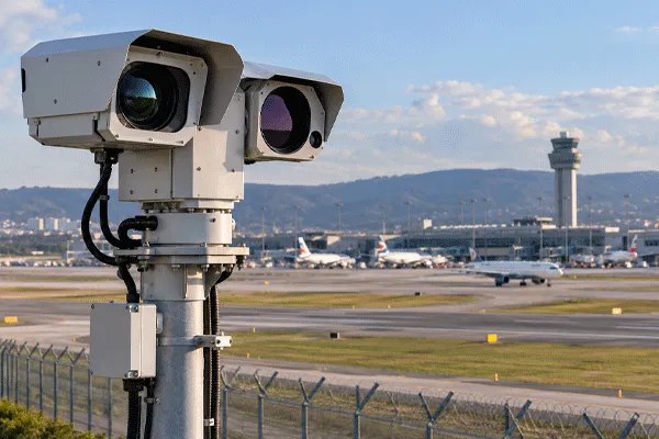
Useful alerts should represent an operational condition, not every radar plot. A project can define observation zones, elevated-attention zones and critical flight-path zones, then apply parameters such as altitude band, direction of travel, speed, track age, persistence and predicted time to boundary. The alert should display the track history, current height, motion vector, relevant runway or corridor and confidence or quality indicators supported by the system. Escalation and notification must follow the airport’s approved workflow. EO/IR can help verify selected tracks, but camera field of view, weather and lighting impose limits.A practical reference is the Midradar radar and thermal-camera bird-monitoring case. For visual confirmation architecture, review the các hệ thống hợp nhất radar-thị giác.
5. Calibration, Baseline and Acceptance
Commissioning should first confirm coordinates, north reference, height datum, time synchronization and map alignment. A baseline period then measures normal clutter, legitimate aircraft and vehicle activity, local bird patterns and alarm workload across different times and weather conditions. Acceptance routes should cross representative runway and approach-corridor volumes at defined heights and directions using an approved test method. Verify detection and track continuity, position residuals, latency, zone entry, alert logging, replay, EO/IR cueing where included, device health and recovery after network or power interruption. Final thresholds must be project-specific and approved by the airport.

Acceptance links surveyed references, route points, alarms, logs and operator outcomes.
6. Airport Survey Inputs and Operational Release Gate
A deployable design starts with an airport information package, not a generic range circle. Collect an approved aerodrome map, runway and taxiway geometry, approach and departure paths, obstacle and building data, terrain or surface model, protected airside boundaries, wildlife attractants, habitat and migration observations, known roosting or feeding areas, prevailing winds, weather visibility records and candidate mounting locations. Record tower and roof access, structural limits, lightning protection, cable routes, power, UPS and generator availability, network zones, time source, command-post displays, existing wildlife reporting tools and the airport stakeholder responsible for each decision. The operational concept should state which volumes are monitored, which target behaviors create observation or risk alerts, how legitimate aircraft and vehicles are handled, when EO/IR or field observation is requested, who validates an event and how information enters the wildlife hazard management process. The acceptance plan should include surveyed static checks and approved representative flight or other authorized test methods across priority heights, directions and masking boundaries. Measure opportunities to detect, track initiation and continuity, position residual, height output where available, update and data age, alert-zone entry, nuisance workload, visual acquisition, recording, device health and recovery. Run baseline monitoring across representative operating periods before freezing thresholds. Release requires signed evidence that priority volumes have been tested, blind zones and limitations are documented, alert rules are operationally usable, operators are trained, data retention is assigned and recovery procedures work. A conditional release must identify the reduced coverage or workflow and its compensating control. Do not release when unresolved masking affects a critical corridor, test activity lacks authorization, alarms overwhelm the approved workflow, coordinate or time alignment is unstable, or stakeholders have not accepted the remaining limitations. The radar remains a decision-support input to the airport wildlife program, not a substitute for biological assessment or approved operating procedures.
Comparison and Acceptance Matrix
| Design item |
Weak approach |
Engineering approach |
Bằng chứng |
| Vùng phủ sóng |
One circular range ring |
3D priority volumes and blind-zone map |
GIS/DSM analysis plus field survey |
| Alerts |
Alarm on every plot |
Zone, altitude, direction, persistence and time-to-boundary |
Recorded scenario tests |
| Rủi ro |
Radar equals strike prediction |
Radar supplements WHMP and operator decisions |
Approved airport procedure |
| Acceptance |
Single demonstration |
Representative routes, conditions and recovery tests |
FAT/SAT report and logs |
Câu hỏi thường gặp
Một radar phát hiện chim có thể bao phủ toàn bộ sân bay không?
Đôi khi có thể, nhưng không bao giờ nên mặc định như vậy. Cần lập mô hình và khảo sát các tòa nhà, địa hình, hình học đường băng và những vùng không phận tầm thấp cần thiết.
Radar 3D có xác định được loài chim không?
Radar có thể cung cấp đặc điểm về đường bay và chuyển động mà hệ thống hỗ trợ. Việc xác nhận loài thường cần thêm bằng chứng hoặc quan sát.
Có nên đặt radar bên cạnh đường băng không?
Không tự động. Vị trí chính xác cần cân bằng giữa tầm nhìn trực tiếp, các hạn chế về an toàn, vật cản, bảo trì, cơ sở hạ tầng và phạm vi phủ sóng của các khu vực ưu tiên.
Kết quả nghiệm thu hữu ích nhất là gì?
Một hồ sơ có thể lặp lại, liên kết tuyến kiểm thử, dữ liệu thực tế/tham chiếu, các vệt radar, cảnh báo, cấu hình hệ thống và kết quả của người vận hành.



 14:40