Wu Kang | Radar System Specialist | Updated September 2026
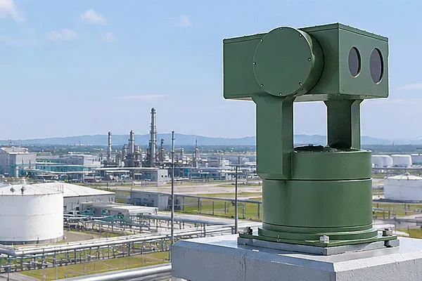
Border surveillance radar detects people, vehicles, vessels, and low-altitude aircraft along a border line using wide-area, all-weather sensors instead of point cameras. A single line can run from open desert to coastline, so agencies typically mix ground/surface radar with low-altitude radar rather than one universal unit.

Border Surveillance Radar: How It Protects 1,000+ km Lines
What “Border Surveillance Radar” Actually Covers
The term gets used loosely. In practice it spans two distinct radar classes doing different jobs along the same line:
- Ground/surface surveillance radar: tracks personnel, vehicles, and vessels moving along or across the line, typically out to tens of kilometers.
- Segurança radar de vigil芒ncia: tracks aircraft, UAVs, and other airborne threats crossing the line at altitude, layered on top of the ground picture.
A border project rarely deploys just one. A river crossing needs vessel detection; a mountain pass needs vehicle and personnel detection; an airspace corridor above either needs UAV detection. The radar mix follows the terrain, not the other way around.
Why Long, Remote Border Lines Are a Different Engineering Problem
A 5 km perimeter around a facility and a 500 km desert border segment are not the same design problem, even though both use “surveillance radar.” Three things change at border scale:
Power and connectivity thin out. Sites are often off-grid or on limited solar/generator budgets, which is why radar power draw (measured in watts, not just detection range) becomes a real selection criterion rather than a footnote.
Terrain and climate swing wider. A single border line can cross desert heat, coastal humidity, and winter cold in the same deployment plan, which is why environmental ratings (operating temperature and ingress protection) matter as much as range figures.
Target mix is unpredictable. The same stretch of line may need to flag a person on foot, a smuggling vehicle, a small boat, and a UAV overflight, each with a different radar cross-section (RCS) and therefore a different real-world detection range even from the same unit.
Midradar’s own deployment base covers 1,000+ km of border and coastline across installed projects, which is the practical reference point for this article: the specification approach below reflects what that scale of deployment actually requires, not a theoretical range figure from a datasheet.
The Two Radar Layers: MR-RDG (Ground/Surface) vs. MR-RDA (Low-Altitude)
Both series are X-band or Ku-band AESA/DBF radar, but they’re specified against different target sets. The table below uses only the ranges published for each model; where a range is tied to a specific radar cross-section (RCS) assumption, that’s noted rather than smoothed over.
| Modelo |
Radar type |
Personnel range |
Vehicle / small boat range |
Large vessel / aircraft range |
Azimuth coverage |
Potência |
Environmental rating |
| MR-RDG50K |
1-D X-band AESA |
≥15 km |
≥25 km |
≥50 km |
90° |
≤200 W |
IP67, -40°C to +55°C |
| MR-RDG20K |
1-D X-band AESA |
≥10 km |
≥15 km |
≥25 km |
95° |
≤140 W |
IP67 |
| MR-RDG07K |
X-band AESA (9.55–9.75 GHz) |
≥10 km @ RCS 0.5 m² |
≥15 km @ RCS 5 m² |
≥25 km @ RCS 10 m² |
90° |
20 W transmit, ≤140 W total |
IP67 |
| MR-RDG06K |
Compact 1-D X-band AESA |
≥5 km |
≥8 km |
≥16 km |
— |
≤75 W |
IP67, ≤5 kg |
| MR-RDG03K |
Compact 1-D DBF Ku-band |
≥3 km |
≥6 km |
≥10 km |
— |
≤85 W |
IP67 |
| MR-RDG03-4R |
Four-sided 1-D DBF Ku-band |
≥3 km |
≥6 km |
≥10 km |
90°/face (see note below) |
— |
IP67 |
| MR-RDA15K-4R |
Four-array 2-D AESA 3D |
— |
≥8 km (vehicle/helicopter) |
Small UAV ≥5 km, altitude to 1,500 m |
360°, elevation -2° to 45° |
≤1.6 kW total |
IP66 system / IP67 host |
| MR-RDA10K-4R |
X-band 2-D phased array, monopulse |
≥12 km |
≥15 km (vehicles/ships) |
Small UAV (RCS 0.01 m²) ≥10 km clear weather |
90°/face, 360° four-face |
— |
— |
The MR-RDG line covers everything from a compact 5 kg unit for short gaps to a 50 km-class unit for open coastline; the MR-RDA line adds the airborne layer that ground/surface radar doesn’t see.

Border Surveillance Radar: How It Protects 1,000+ km Lines
How Range Actually Changes With Target Type, and Why That Matters for Procurement
The MR-RDG07K datasheet is the clearest illustration of why a single “detection range” number is misleading: the same radar reaches 25 km against a 10 m² target (a large vehicle or boat), 15 km against a 5 m² target, and 10 km against a 0.5 m² target (a person). Radar cross-section, not the radar alone, sets the effective range. A procurement spec that asks only “what’s the detection range” without naming the target RCS will get a technically true but operationally useless number.
This is also why the MR-RDA10K-4R’s small-UAV figure (≥10 km against a 0.01 m² target) is qualified as “clear weather” rather than stated as an unconditional maximum. Small UAVs are the lowest-RCS target class most border projects need to detect, so their range figure is the most weather-sensitive one on a spec sheet, and worth confirming against the actual regional climate at quote stage.
Multi-Sensor Integration for Border Command Centers
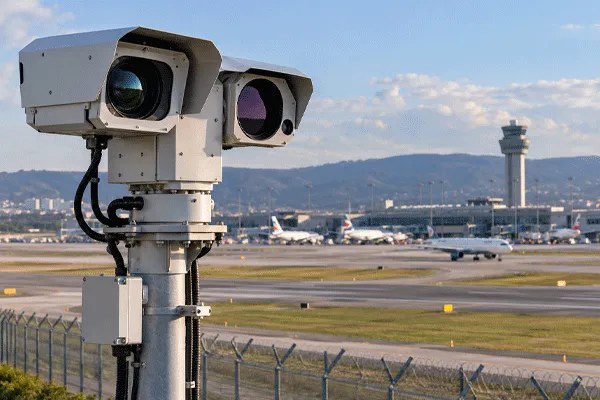
Radar alone gives a track; it doesn’t give visual confirmation. Border deployments pair radar with electro-optical/thermal cameras in a radar-vision fusion arrangement, where the radar track cues the camera to slew to the target automatically rather than requiring an operator to manually steer toward every alert. For integration into an existing command platform, VMS, or C2 system, the relevant open standards are GB/T 28181, ONVIF, and RTSP, alongside RESTful APIs and SDKs for deeper platform-level integration. These are the protocols to confirm compatibility against before specifying a system, rather than assuming proprietary lock-in.
Compared to single-sensor approaches still common on older or lower-budget border segments (seismic/PIR ground sensors, or camera-only towers with no radar cueing), a radar-cued, multi-sensor layer reduces the operator workload of manually scanning wide, low-activity stretches of line for the handful of genuine crossings per shift.
Two Deployment Edge Cases Worth Asking About Before You Order
MR-RDG03-4R azimuth coverage. The published spec page lists 90° per face for this four-sided unit but doesn’t explicitly confirm whether the intended full-azimuth (360°) coverage is achieved by the four faces working as one assembled system or needs to be verified per installation. For a project relying on this unit for gapless perimeter coverage, confirm the assembled-system azimuth figure directly with a current datasheet rather than assuming 4 × 90° automatically equals 360° with no overlap or blind arc.
MR-RDA10K-4R conflicting spec pages. This model has two published product pages listing materially different specifications under the same model name. Until that’s resolved on the manufacturer side, treat any MR-RDA10K-4R figure as provisional and request a signed, current datasheet before it goes into a bid or design document — this is exactly the kind of discrepancy that causes rework late in a procurement cycle if it’s caught after equipment has shipped rather than before the quote is finalized.
A Framework for Specifying Border Radar Coverage
- Segment the line by terrain and target mix.Desert, coastline, river crossing, and mountain pass each imply a different radar class and range requirement; map this before selecting models, not after.
- Set the range requirement against the smallest relevant RCS, not the largest. If personnel detection matters, size the radar to the personnel range figure, not the large-vessel figure on the same datasheet.
- Check power and connectivity against the actual site.A 1.6 kW system needs grid or substantial generator capacity; a sub-100 W unit is viable on solar in most climates.
- Confirm environmental rating against the harshest point on the segment, not the average. A line that touches both desert heat and coastal salt air needs the rating validated for both.
- Decide the airborne layer separately from the ground layer.If UAV or low-altitude aircraft threats are in scope, MR-RDA-series coverage is a separate line item, not something the ground/surface radar picture already includes.
- Request the current signed datasheet for any model with a known spec discrepancy(see edge cases above) before finalizing a bid.

Border Surveillance Radar: How It Protects 1,000+ km Lines
What This Costs
Midradar does not publish list pricing for the MR-RDG or MR-RDA series. Border radar pricing depends on range class, quantity, mounting infrastructure, and whether radar-vision fusion or platform integration is included in the scope, so a quote is required to get an accurate number for a specific segment plan.
Trade-offs Worth Weighing
Radar-centered detection covers distances and weather conditions that camera-only systems can’t match, and it reduces the false-alarm load that plagues seismic/PIR-only systems on vegetated or windy terrain. The trade-off is that radar alone doesn’t identify a target — it hands off to a camera or an operator for visual confirmation, which means the fusion and platform layer isn’t optional if the goal is an actionable alert rather than just a track on a screen. The MR-RDA15K-4R’s 1.6 kW power draw is a genuine constraint for solar-only or off-grid airborne-layer sites, and it’s worth checking against the site’s actual power budget before it’s specified, not after installation.
Perguntas Frequentes
Qual é o alcance máximo para radar de vigilância de fronteira?
Depende do tamanho do alvo. O MR-RDG50K da Midradar alcança aproximadamente 50 km contra um alvo de classe embarcação grande, mas a detecção em escala de pessoal na mesma unidade atinge no máximo cerca de 15 km, porque a seção transversal do radar, não o radar sozinho, define o alcance efetivo.
Preciso de radar separado para ameaças terrestres e ameaças de UAV?
Geralmente sim. Radar de solo/superfície (série MR-RDG) e radar de baixa altitude (série MR-RDA) são especificados para conjuntos de alvos diferentes e normalmente são implantados como duas camadas no mesmo segmento de fronteira, em vez de uma unidade universal.
Como o radar de vigilância de fronteira se integra com uma plataforma de comando existente?
Por meio de protocolos abertos, incluindo GB/T 28181, ONVIF e RTSP, além de APIs RESTful e SDKs, em vez de uma interface proprietária fixa. Confirme qual VMS, plataforma C2 ou sistema de alarme precisa ser conectado antes de especificar.
Quais condições ambientais este equipamento suporta?
As linhas MR-RDG/MR-RDA são classificadas para temperatura de operação de -40°C a +55°C com proteção contra ingresso IP66/IP67, o que cobre calor desértico, umidade costeira e frio de inverno em uma única linha de fronteira.
Os preços estão disponíveis online?
Não. As páginas de produtos da Midradar direcionam para uma solicitação de orçamento em vez de preços publicados, já que o custo do radar de fronteira depende da classe de alcance, da quantidade e do escopo de integração.
Qual é o maior erro na especificação de radar de fronteira?
Dimensionar todo o sistema com base no valor de alcance para o alvo maior na ficha técnica (por exemplo, o número para embarcações grandes), em vez do menor alvo relevante, pessoal ou pequeno UAV, que é o valor que realmente determina se o sistema detecta as ameaças que mais importam para o projeto.




 09:57