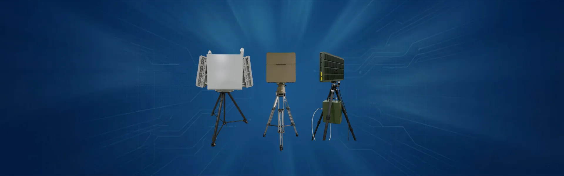
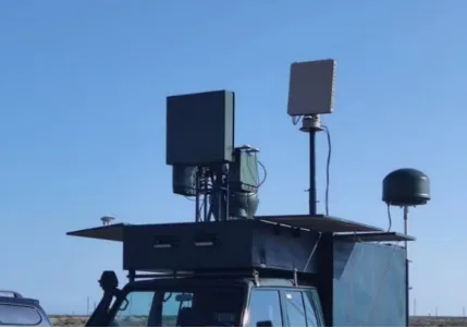
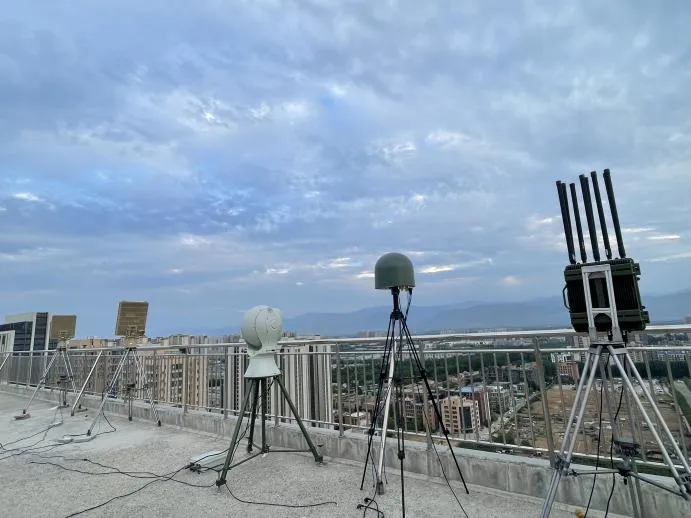
Radar di sorveglianza a bassa quota MR-RDT02K
Banco economico e facile da usare, con manometri e controllo manuale.
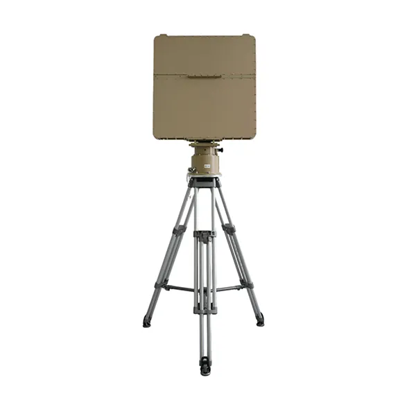
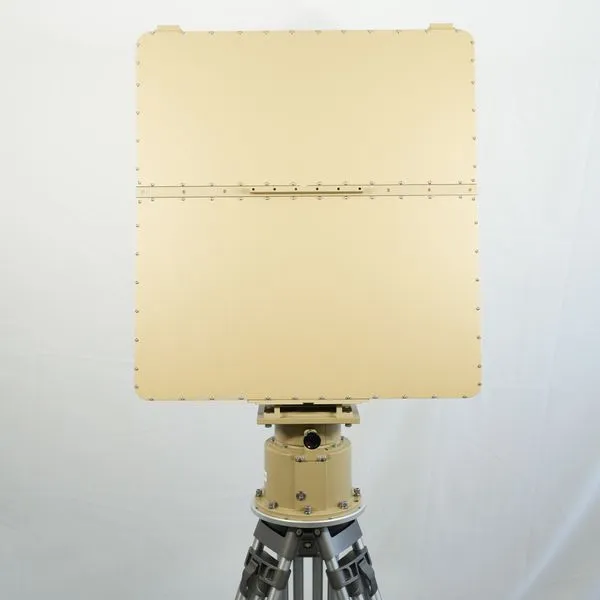
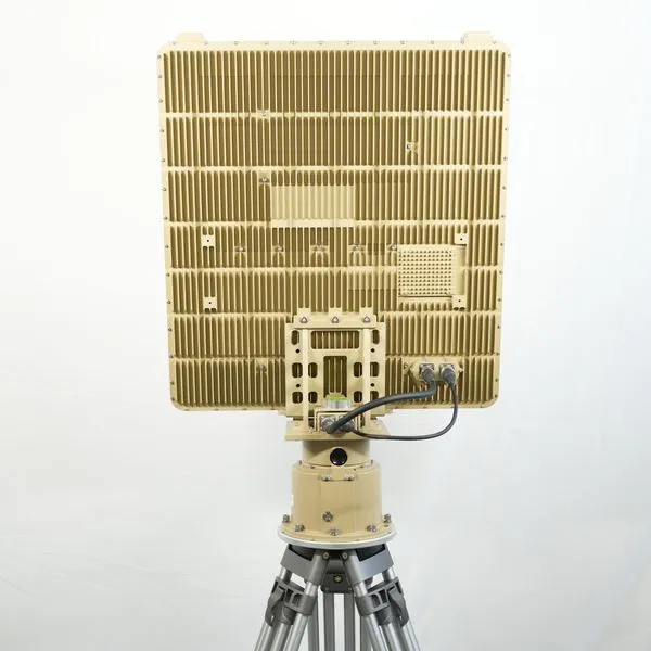
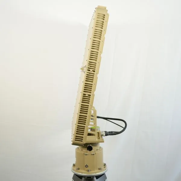
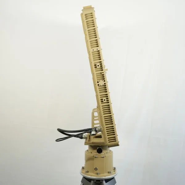
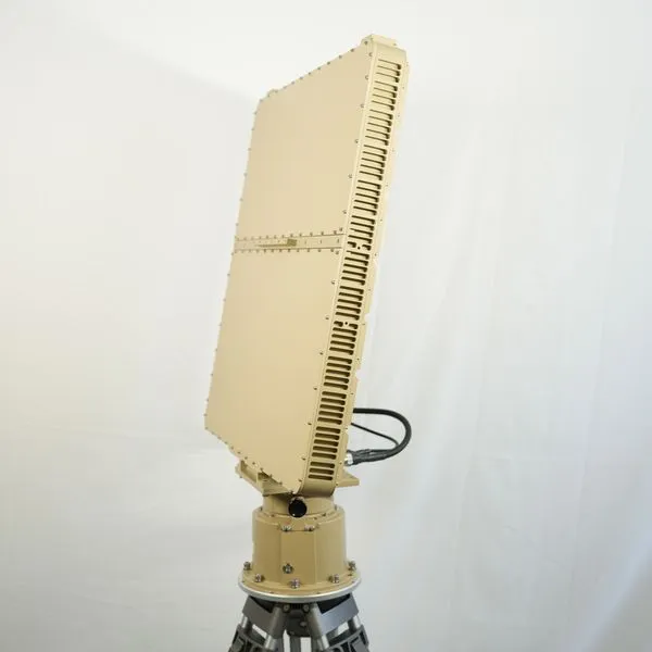
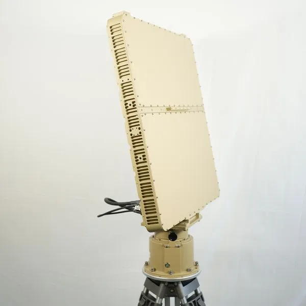
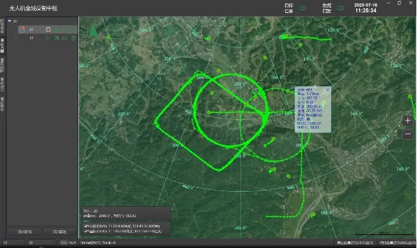
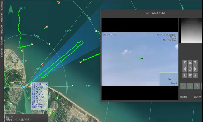
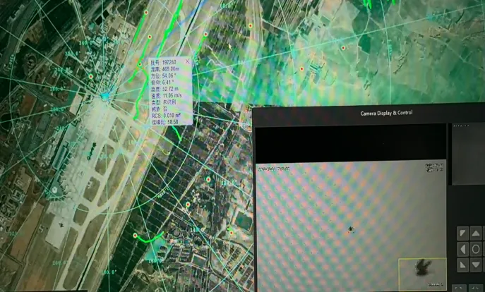
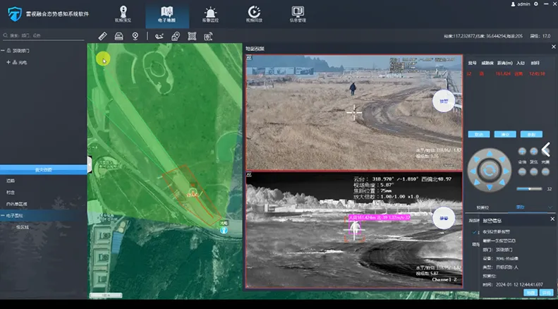
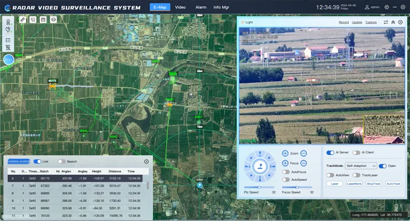
Il radar di sorveglianza a bassa altitudine MR-RDT18K è un sistema radar tridimensionale in grado di rilevare integratamente aria, terra e superfici acquatiche. Può rilevare e tracciare continuamente droni, aeromobili, uccelli, personale, veicoli e imbarcazioni all'interno della sua area di copertura. Utilizzando la tecnologia multi-fascio simultanea e tecniche di elaborazione del segnale ad alte prestazioni, il radar può acquisire rapidamente e con precisione la posizione e lo stato di movimento dei bersagli anche in ambienti complessi con più bersagli. Il radar adotta una modalità di funzionamento a onda continua con bassa potenza di trasmissione, migliorando significativamente la resistenza all'intercettazione elettromagnetica rispetto ai sistemi radar a impulsi. All'interno di sistemi di rilevamento cooperativi, funge da unità sensoriale principale, fornendo dati di target ad alta precisione a dispositivi elettro-ottici e altri sistemi per un'operazione coordinata.
Preventivo gratuitoIl radar di sorveglianza a bassa altitudine MR-RDT18K integra la rilevazione dello spazio aereo, del terreno e della superficie acquatica in un sistema unificato. Supporta il monitoraggio e il tracciamento in tempo reale di droni, aeromobili, uccelli, veicoli, personale e imbarcazioni su ampie aree di copertura.
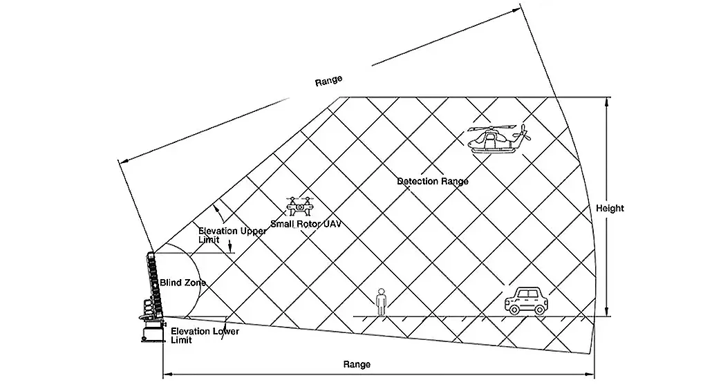
Il radar utilizza la scansione meccanica dell'azimut combinata con la formazione digitale del fascio (DBF) in elevazione, ottenendo una copertura azimutale di 360° e un tracciamento efficiente di più bersagli.
Con avanzati processi di segnale e algoritmi di tracciamento, il sistema mantiene alta precisione e stabilità in ambienti complessi, comprese condizioni di clutter urbano.
Elevata precisione di rilevamento
Fornisce misurazioni precise di distanza, velocità, azimuth e altitudine basate su un avanzato processamento del segnale e architettura di sistema.
Rilevamento Ampia Area ad Alta Capacità
La scansione meccanica dell'azimut e la DBF in elevazione consentono una copertura completa a 360° e una capacità di tracciamento multi-target su vasta area.
Alta Frequenza di Aggiornamento e Tracciamento Preciso
Algoritmi di tracciamento avanzati migliorano le prestazioni per bersagli ad alta velocità e manovrabili.
Alta Sensibilità e Basso Tasso di Falsi Allarmi
La tecnologia di soppressione del clutter garantisce il rilevamento di bersagli deboli con bassa probabilità di falsi allarmi.
Forte Capacità Anti-Interferenza da Clutter
Consente il tracciamento stabile di bersagli a quota ultra-bassa in ambienti complessi con clutter urbano.
Eccellente Performance Anti-Intercettazione Elettromagnetica
L'operazione a onda continua riduce il rischio di intercettazione e migliora la resistenza alle interferenze e le prestazioni di occultamento.
Semplice da Usare e Portatile
Design modulare e interfaccia intelligente supportano un rapido dispiegamento e alta mobilità.
| Parametro | Specifiche |
| Banda operativa | Banda X |
| Tecnologia | Scansione Azimut Meccanica + Elevazione DBF |
| Campo di rilevamento | 15 km |
| Altitudine massima di rilevamento | 2000 m |
| Zona cieca | 50 m |
| Copertura azimutale | 360° |
| Copertura dell'elevazione | -4° ~ 60° |
| Campo di misura della velocità | 1-150 m/s |
| Rilevamento di piccoli UAV | ≥8 km |
| Rilevamento UAV di Media Dimensione | ≥15 km |
| Rilevamento di veicoli/elicotteri | ≥15 km |
| Gamma Precisione | ≤5 m |
| Precisione della velocità | ≤0,5 m/s |
| Precisione dell'angolo | ≤0,4° |
| Frequenza di aggiornamento | 1s / 2s / 3s |
| Capacità di tracciamento | ≥300 bersagli |
| Temperatura di esercizio | -40℃ ~ +55℃ |
| Livello di protezione | IP66 (Host IP67) |
| Alimentatore | DC 36–52V |
| Consumo Energetico | ≤330W |
| Comunicazione | Ethernet |
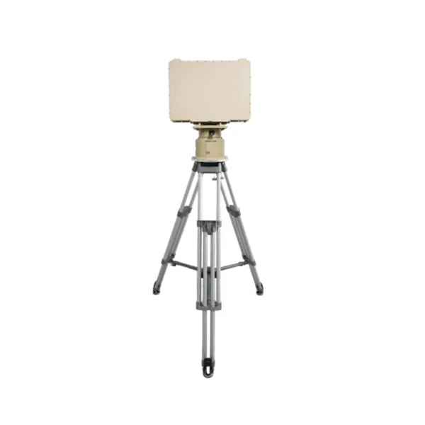
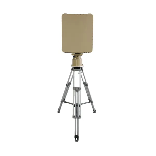
| Peso | ≤35 kg |
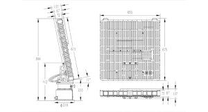
| Articolo | Dimensioni (mm) | Peso (kg) | Dim. imballata (mm) | Peso imballato (kg) |
| Unità Host | ≤650*675*107 | ≤19 | ≤790*740*230 | ≤35 |
| Basamento | ≤412*Φ225 | ≤14 | ≤360*360*480 | ≤22 |
| Treppiede | ≤940*230*230 | ≤12 | ≤1140*290*290 | ≤15 |
| No | Nome | Quantità | Unità | Descrizione |
| 1 | Unità host radar | 1 | Unità | |
| 2 | Basamento Radar | 1 | Unità | |
| 3 | Treppiede | 1 | Unità | |
| 4 | Custodia di Trasporto Unità Principale Radar | 1 | Unità | Custodia per il trasporto in lega di alluminio |
| 5 | Custodia di Trasporto Piatto Radar | 1 | Unità | Custodia per il trasporto in lega di alluminio |
| 6 | Adattatore di alimentazione | 1 | Cavo | AC220V a DC48V, Lunghezza 15m |
| 7 | Cavo di comunicazione | 1 | Cavo | Collega il radar al terminale di visualizzazione e controllo, lunghezza 15 m |
| 8 | Strumenti di montaggio e viti | 1 | Set | Per il montaggio di host, piedistallo e treppiede |
| 9 | Documento | 1 | Copia | Manuale d'uso, ecc. (versione elettronica) |
Banco economico e facile da usare, con manometri e controllo manuale.
Progettato per il rilevamento e il tracciamento affidabile di obiettivi a bassa quota in ambienti complessi, ideale per il monitoraggio degli UAV, la sicurezza delle frontiere e la protezione delle infrastrutture critiche.
Progettato per il rilevamento a lungo raggio a bassa quota e il tracciamento di più bersagli, ideale per il monitoraggio degli UAV, la sicurezza delle frontiere e i sistemi di sorveglianza di grandi aree.
Progettato per il rilevamento a lungo raggio a bassa quota e l'inseguimento multi-obiettivo ad alta capacità, è adatto alla sorveglianza di grandi aree e ai sistemi avanzati di contro-UAV.
Contattateci e vi risponderemo al più presto.
Vi risponderemo entro 24 ore. Se per il caso urgente, si prega di aggiungere WhatsApp/WeChat: +86 15954290051,. Oppure chiamare direttamente il numero +86 15964215221.
*Rispettiamo la vostra riservatezza e tutte le informazioni sono protette.
Utilizzeremo le vostre informazioni solo per rispondere alle vostre richieste e non invieremo mai e-mail non richieste o messaggi promozionali.